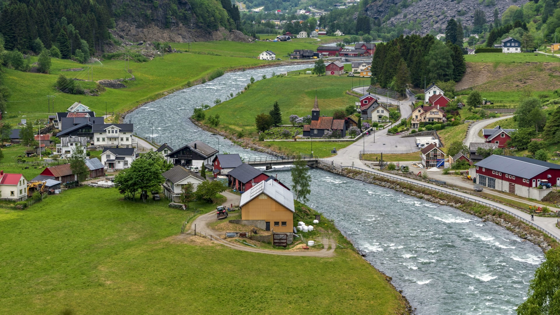
The Flåm river running past green meadows and houses in the Flåm valley

Cycling in Norway

Rallarvegen cycle route: from the mountains at Finse down to the fjord at Flåm

At Finse the snow still lines the gravel in July, and the Oslo to Bergen train rumbles past below the glacier. A few hours later you roll into Flåm, two metres above sea level. Here is what to know before you go.

17 November 20269 min read

© Yogendra Negi / Unsplash

The train from Oslo drops you at Haugastøl, where the tourist centre runs the bike hire. You are almost a thousand metres up. Ahead runs a gravel track built in the 1890s and early 1900s by the rallare, the navvies who carried materials up for the Bergen Railway. It crosses the edge of the Hardangervidda plateau to Finse, passes Hallingskeid and Myrdal, then drops through the Flåm valley to the fjord.

Rallarvegen, literally the navvies' road, is Norway's best known bike ride, and more than 20,000 people cycle it every year. It is not a road route. Think gravel, loose stone and the odd snowfield, finished by a descent that will test your brakes and your nerve. In return, there are almost no cars, and you cross a landscape most visitors only see through a train window.

In short

  • Gravel, not tarmac: Almost all of it is gravel, rough and rocky in places. Bring a mountain bike, a gravel bike or a sturdy hybrid. Leave the road bike at home.

  • Climbing: A long, gentle rise from Haugastøl to the high point near Fagernut, about 1,340 metres. After that it is mostly downhill, and the last 20 km from Myrdal lose more than 800 metres.

  • Distance: Haugastøl to Flåm is about 80 km. Finse to Flåm, the most popular version, is 53 km.

  • Season: The whole route is usually not passable until late July. The riding season runs from July to September.

  • Trains: Bike spaces on the Bergen Railway and the Flåm Railway must be booked in advance.

Rallarvegen at a glance

Haugastøl to Flåm
about 80 km 79.4 km on the ut.no route
Highest point
1,340 m near Fagernut, between Finse and Hallingskeid
Lowest point
2 m Flåm, at the head of the Aurlandsfjord
Myrdal to Flåm
about 20 km from 867 m down to sea level
Hairpin bends
21 down the Myrdal mountainside
Surface
Gravel tarmac for the last stretch of the Flåm valley
Season
July to September snow near Fagernut well into July
Bikes on trains
Book ahead 15 bike spaces on each line
Riders a year
20,000+ according to Wikipedia

Last checked:

Chapter 1 · Finse

1,222 m

Finse station above sea level

Where winter lingers

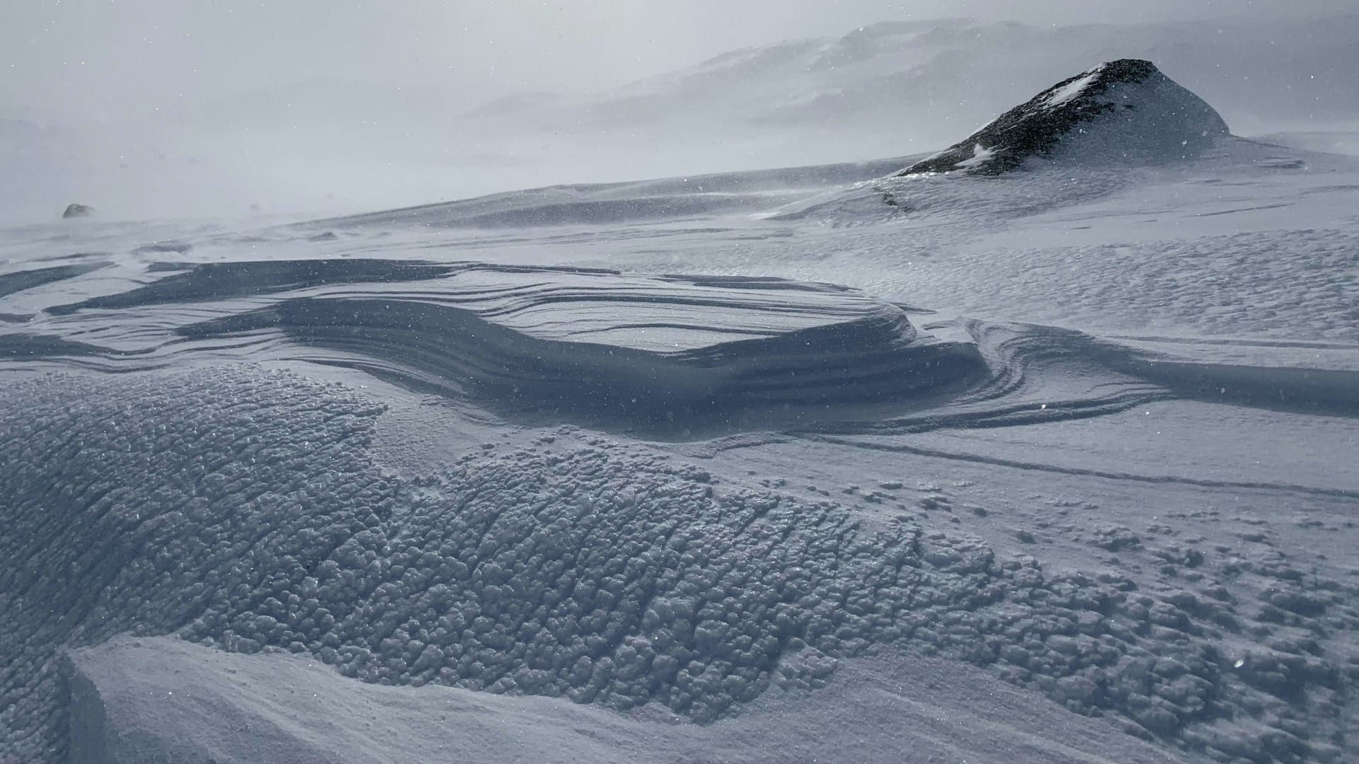
Finse station sits 1,222 metres above sea level, the highest on the line. Snow can line the track into late summer, and early in the season the hire firms suggest taking the train on to Hallingskeid. Pack warm layers, even in July.

Wind-sculpted snow on the high mountain plateau at Finse

Chapter 2 · Myrdal

867 m

Myrdal station above sea level

Where two railways meet

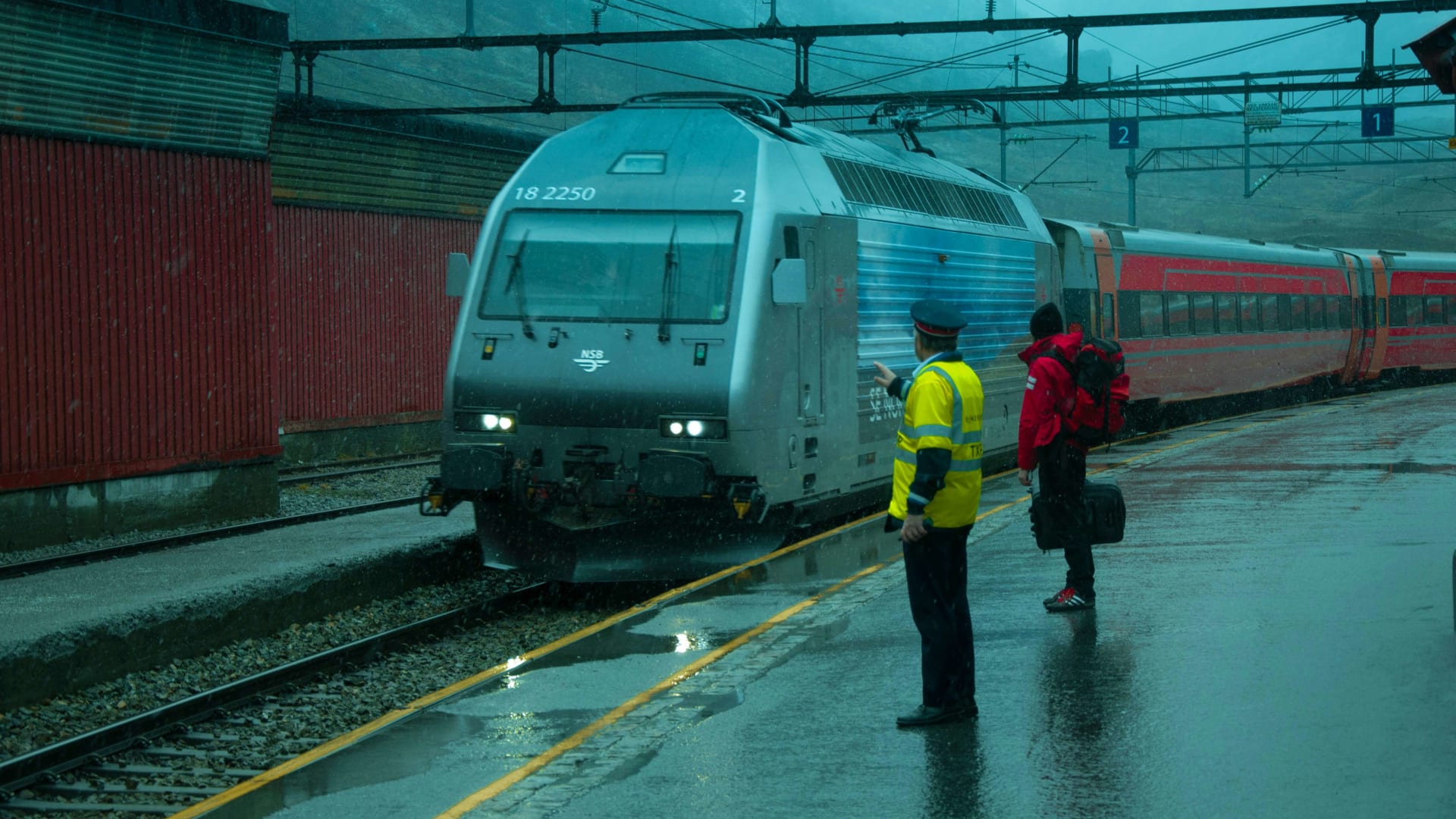
At Myrdal the Bergen Railway meets the Flåm Railway. You can load the bike onto the train here and ride down in comfort, or carry on along the gravel towards the hairpins. Vatnahalsen, just beyond, is a natural place to stop.

A train and passengers on the platform at Myrdal station in the rain

Chapter 3 · The Flåm valley

20

tunnels on the Flåm Railway

The train down the same valley

The Flåm Railway is 20.2 km long with 20 tunnels and a gradient of up to 55 per thousand. It brings you back up to Myrdal after the descent, but only if you have booked a bike space.

The green Flåm Railway train rounding a bend between rocks and shrubs

Gentle up, steep down

Rallarvegen is kinder on the way up than people expect and harder on the way down. From Haugastøl, at 988 metres, the track climbs gradually over 27 km to Finse. From there it is ten kilometres, and the only real climb of the route, to the high point near Fagernut at about 1,340 metres. The surface here is rough, and early in the season you will be pushing across snowfields.

Towards Hallingskeid the track mostly falls, but at Kleivagjelet, a narrow gorge, it is tight and exposed. If heights or loose gravel make you uneasy, get off and walk. Just past it you cross Kleivabrua, a stone bridge with a 35 metre span built by the same navvies.

The real test comes after Vatnahalsen. Here the road zigzags through 21 hairpin bends down the Myrdal mountainside, beside the river and waterfall, with loose gravel on the corners. Your brakes work the whole way. Riding with children, or new to gravel descents, walk the bike down the steepest bends: UT.no, the Norwegian Trekking Association's route portal, advises exactly that for families. Lower down the Flåm valley the gravel turns to tarmac, and the road is public, with local traffic.

A waterfall on a forested mountainside seen through a train window on the way to FlåmAbby Rurenko / Unsplash
The Flåm valleyYou see the waterfalls from the train too. From the saddle you also hear them.

The profile

Up onto the plateau, down to the fjord

Rallarvegen has one long, gentle climb and one steep descent. Here are both, so you can see where the effort goes and where the brakes take over.

Haugastøl to Fagernut · Light traffic

Up: the long, gentle plateau

From Haugastøl the track rises steadily to Finse at 1,222 metres and on for ten kilometres to Fagernut. The average gradient is low, but gravel, wind and snow slow you down. Allow three to four hours to Finse.

From / To
Haugastøl 988 m → Fagernut 1,340 m
Length
37 km
Average
1 %

Descent · Light traffic

Down: 21 hairpins and 865 metres

The final 20 km drop from Myrdal to the fjord. The steepest part is the hairpins down the mountainside, on loose gravel and a narrow road. Take it slowly, and walk if in doubt.

From / To
Myrdal 867 m → Flåm 2 m
Length
20 km
Average
4.3 %
Hairpins
21

Which section to ride

Easy: Myrdal to Flåm

Take the train to Myrdal and ride the last 20 km down to the fjord. It is almost all downhill, but the hairpins demand good brakes and patience. This is the section most families choose, and it often opens earlier in the summer than the high plateau.

Moderate: Finse to Flåm

53 km and about six hours of riding. You get the high point at Fagernut, the open plateau past Hallingskeid and the full descent. Hire a bike at Finse and you can drop it off in Flåm. This is the classic version, suitable for adults and teenagers with some cycling experience. The recommended minimum age is 12.

Hard: Haugastøl to Flåm

The whole route, about 80 km with nearly 700 metres of climbing. Many split it over two days with a night at Finse. Starting early from Haugastøl you can do it in one, but with little time for stops and no margin if snow still blocks the track near Fagernut.

HaugastølFinse1,214 mHallingskeid1,044 mMyrdal895 mFlåm0 m

Simplified map. Colours show traffic: green light, yellow some. Distances from ut.no and Norway's Best.

The route

Plateau to fjord in four stages

Scroll to ride the whole of Rallarvegen from Haugastøl to Flåm.

  • Gravel
  • Light traffic
  • Some traffic

Gravel · 27 km · 983 → 1,214 m · Light traffic

Beside the railway to Finse

A steady climb alongside the tracks. You may meet a few cars near Haugastøl. Further west the road is closed to ordinary motor traffic.

  • Gravel
  • Gentle climb

Gravel · 21 km · 1,214 → 1,044 m · Light traffic

Over Fagernut

The only real climb, to the high point at about 1,340 metres. Rough surface and snowfields early in the season.

  • High point
  • Snow

Gravel · about 15 km · 1,044 → 895 m · Light traffic

Past Kleivagjelet to Myrdal

Mostly downhill. Walk past the Kleivagjelet gorge if you feel unsure, and stop at Vatnahalsen.

  • Downhill
  • Narrow track

Gravel · about 20 km · 895 → 0 m · Some traffic

The 21 hairpins to the fjord

Loose gravel on the hairpins, then tarmac and local traffic down the valley. The train takes you back up.

  • 21 hairpins
  • Local traffic

Traffic and quiet stretches

  • Quiet: From the county boundary westwards, over Finse, Fagernut and Hallingskeid, the road is closed to ordinary motor traffic. You share it with walkers, other riders and the railway.

  • Some traffic: Near Haugastøl you may meet cars. In the lower Flåm valley the road is a tarmac municipal road, with local traffic and other cyclists coming down fast. It is narrow, so keep right on the bends.

  • Snow and surface: Conditions vary a lot from year to year. Check the latest reports before you travel, and have a plan B: the train from Finse to Hallingskeid if the snow has not gone.

Trains, hire and where to stop

Haugastøl, Finse and Myrdal are all stations on the Bergen Railway. Both the Bergen Railway and the Flåm Railway have 15 bike spaces that must be reserved in advance, and on the Flåm Railway they can only be booked in summer, when Rallarvegen is open between Myrdal and Flåm. Book early: July fills up.

If you would rather not bring your own bike, you can hire at Haugastøl or Finse and return it at Haugastøl, Finse, Myrdal or Flåm. The hire season usually runs from mid July to the end of September. Helmets are not for hire, so bring your own. The farm café at Kårdalstølen in the Flåm valley opens from June to September, and at Finse there is a hotel as well as Finsehytta, a mountain lodge run by the Norwegian Trekking Association.

A yellow wooden house on a snowy mountainside along the Flåm Railway near MyrdalRE Walsh / Unsplash
MyrdalHigh up, the snow stays late. The road opens only when it has gone.

Frequently asked questions

Can you ride Rallarvegen on a road bike?

It is not recommended. The route is gravel, rough and rocky in places, so a mountain bike, gravel bike or sturdy hybrid is the right choice.

When does Rallarvegen open for cycling?

It depends on the snow. Myrdal to Flåm can often be ridden from early summer, while the full route over Fagernut is usually not passable until mid or late July.

How long does it take to cycle from Finse to Flåm?

Allow five to six hours for the 53 km, not counting stops. Snowfields and narrow sections can slow you down early in the season.

Is Rallarvegen suitable for children?

The recommended minimum age is 12, although experienced younger riders can manage parts of it. Children often need help over snow and down the hairpins near Myrdal.

Do I need to book a bike space on the Flåm Railway?

Yes. Bike spaces must be reserved in advance, and on the Flåm Railway they can only be booked in summer, while Rallarvegen is open between Myrdal and Flåm.