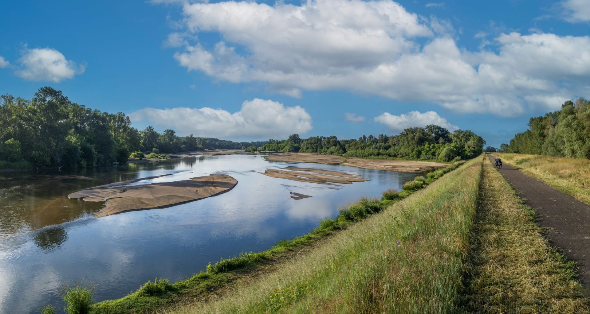
Grassy levee with a path beside the Loire and sandbanks in the river

Cycling in Europe

Loire à Vélo: cycling the Loire Valley château route

The levee is wide enough for two bikes, the river is braided with sandbanks, and the next château appears before lunch. The Loire à Vélo is flatter than you expect, and less traffic free than the brochures suggest.

17 November 20269 min read

© snap wander / Unsplash

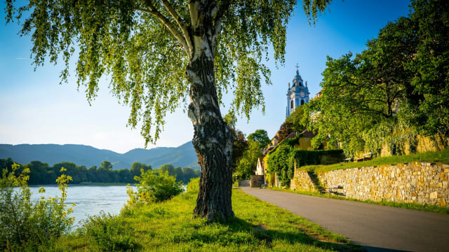
Morning on the levee outside Blois. The river is low and brown, sandbanks lie like spines in the current, and the only sounds are your tyres and the wind in the grass. In an hour you will be standing in front of a château with coaches queuing at the gate. For now it is just you, the path and 43 km to Amboise.

La Loire à Vélo is the cycle route along the Loire from Cuffy, near Nevers, to Saint-Brévin-les-Pins on the Atlantic. It forms the western end of EuroVelo 6, and the stretch most people ride runs through château country between Blois and Saumur. Distances are short, there is a lot to see, and a train is rarely far away when your legs give up.

The short answer

  • Flat or hilly: Almost completely flat. The highest point on the whole route is 185 metres above sea level, with short climbs up to some towns and châteaux.

  • Distance: 630 km from Nevers to the sea, around 900 km including all the variants and loops.

  • Traffic: Only 37 per cent is dedicated cycle path. The rest is shared with cars, mostly on quiet lanes, but not always.

  • Signposting: Signed in both directions with the Loire à Vélo logo and the EuroVelo 6 number.

  • Where to stay: Accueil Vélo hotels, a French label for cyclist-ready accommodation with secure bike storage, in Blois, Amboise, Tours or Saumur.

Loire à Vélo at a glance

Main route
630 km Nevers to Saint-Brévin-les-Pins
With variants
c. 900 km loops to châteaux and towns
Dedicated cycle path
239 km 37 per cent, the rest is shared road
Highest point
185 m above sea level, the lowest is the coast
Flat
569 km gradient between -1 and 2 per cent
Smooth surface
86 % tarmac or similar
Accueil Vélo stays
694 along the route
Official stages
37 from Nevers to the Atlantic
Bikes on TER trains
free no booking, subject to space

Last checked:

Chapter 1 · Chambord

over 30 km

of cycle tracks on the Chambord estate

The château in the forest

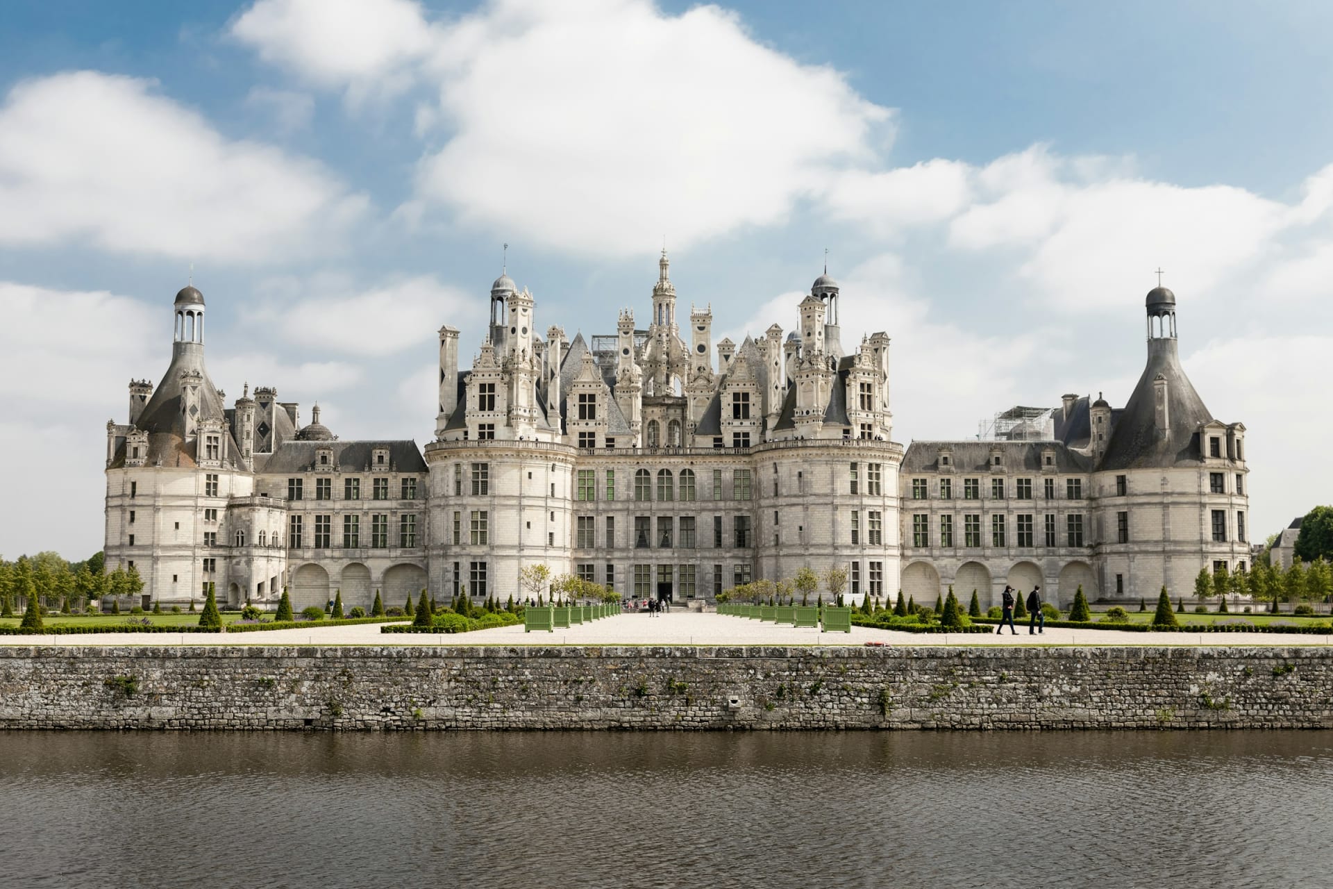
Chambord sits back from the river, but a Loire à Vélo variant runs through its park. The estate has more than 30 km of waymarked cycle tracks, including a 4.2 km loop along the canal around the château.

The façade of Château de Chambord above the water

Chapter 2 · Blois

43 km

from Blois to Amboise

Over the bridge

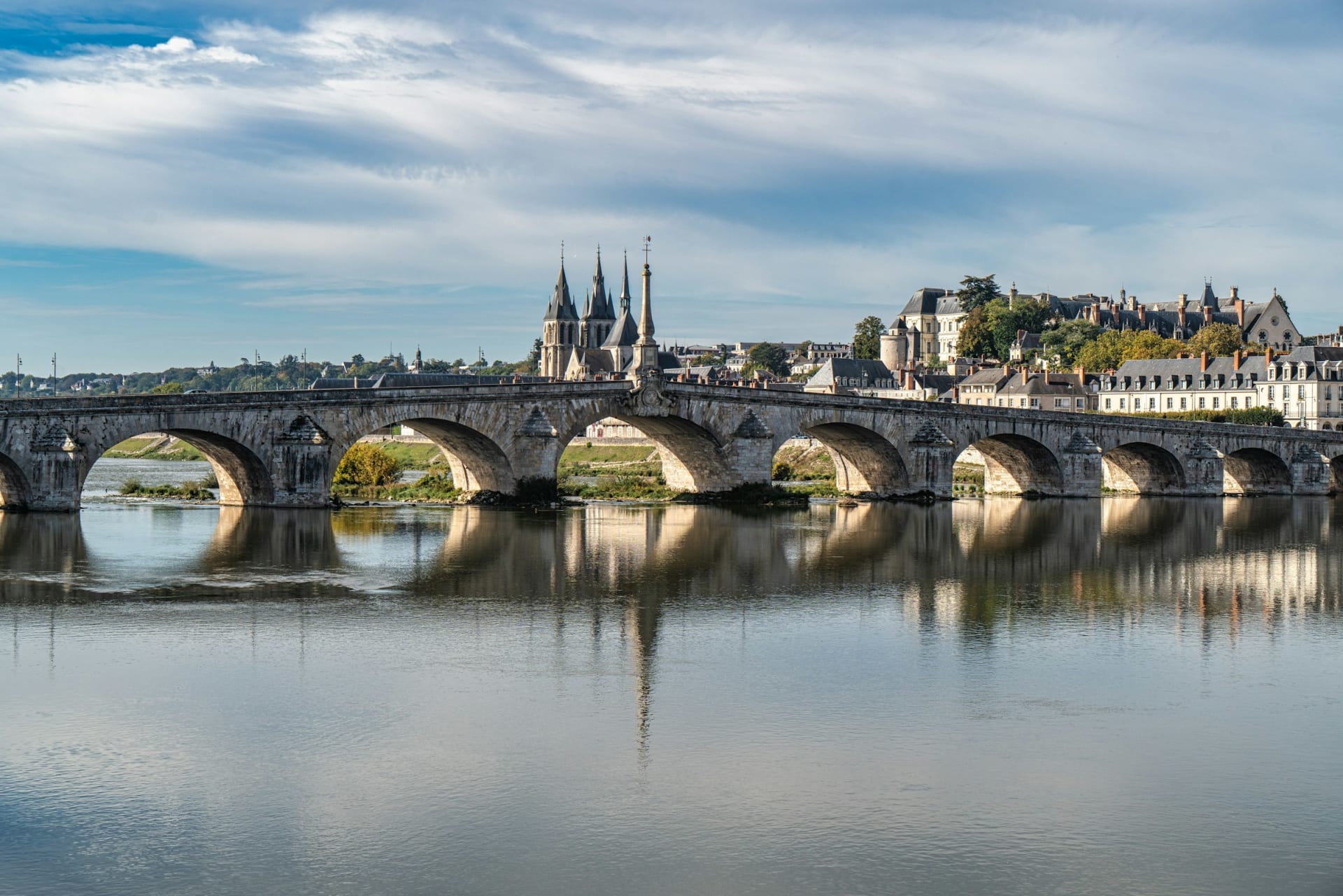
Blois is the obvious base for the château loop. Waymarked loop 9, 33 km long, links Blois with Chambord, while the main route carries on west along the Loire towards Chaumont and Amboise.

The stone bridge over the Loire at Blois with the old town behind

Chapter 3 · Amboise

27 km

from Amboise to Tours

Above the river

In Amboise the château sits above the Loire, so a visit means a short climb through town. From here it is 27 km on to Tours via Montlouis-sur-Loire.

Château d'Amboise seen through the trees of the castle garden

Chapter 4 · Chenonceau

c. 12 km

from Amboise to Chenonceau

The detour to the Cher

Chenonceau spans the river Cher, not the Loire. From Amboise you follow signs for Chenonceaux, about 12 km, or a longer forest route of around 20 km via loop 47.

Château de Chenonceau on its arches over the river Cher

Flat, with a few climbs to the châteaux

The Loire is a river without mountains. Across the entire route there are only 185 metres between the lowest and highest points, and 569 of the 630 km have a gradient between minus one and two per cent. France Vélo Tourisme rates it at its easiest level, suitable for beginners.

The hills arrive when you leave the river. Several towns and châteaux sit on the escarpment above the water, and the Blois to Amboise stage is described as easy with a few slopes. The south bank from Blois to Candé-sur-Beuvron runs through vineyard slopes, which brings more up and down than the levee.

What catches people out is the wind. The prevailing wind blows from the west, and most riders head west towards the sea. If you are not used to long days, France Vélo Tourisme suggests starting at the coast and riding east with the wind behind you.

Château de Saumur on the hill above the town and the LoireAndréa Villiers / Unsplash
SaumurThe château stands on the bluff above the river, as so many do here.

Suggested routes

Easy: Blois to Amboise

43 km beside the river, via Chaumont-sur-Loire. Split the day with lunch in Chaumont and save the Amboise château for the afternoon.

Moderate: château week from Blois to Saumur

Blois to Chaumont 20 km, Chaumont to Amboise 23 km, Amboise to Tours 27 km, Tours to Villandry 22 km, Villandry to Rigny-Ussé 21 km, Rigny-Ussé to Candes-Saint-Martin 25 km and Candes-Saint-Martin to Saumur 17 km. Around 155 km in seven short days, or four at a brisker pace. Add a day for Chambord and another for Chenonceau.

Challenging: Orléans to the sea

From Orléans to Saint-Brévin-les-Pins is several hundred kilometres over more than 25 official stages. Nothing is steep, but you need a week or two in the saddle, and the westerly wind becomes part of daily life.

Trains with your bike

Bikes travel free on regional TER trains in Centre-Val de Loire and Pays de la Loire. Spaces cannot be booked, so avoid weekday rush hours, 7 to 9am and 5 to 7pm. In summer the Train Loire à Vélo runs on the Orléans, Tours, Angers, Nantes and Le Croisic line with carriages set aside for bikes. The booking rules have changed in recent years, so check them before you travel.

BloisChaumont-sur-Loire75 mAmboise61 mTours57 mVillandry48 mSaumur36 m

Simplified map. Colour is our estimate from the type of route: green dedicated path, amber shared lanes with light traffic. Distances follow the official stages.

The route

Château week from Blois to Saumur

Scroll to ride west along the river.

  • Bike
  • Light traffic
  • Some traffic

Bike · 20 km · 79 → 75 m · Light traffic

Vineyards on the south bank

From Blois the route follows the south bank through vineyard slopes past Candé-sur-Beuvron. Expect a few short climbs.

  • Vineyards
  • Short climbs

Bike · 23 km · 75 → 61 m · Some traffic

On to Amboise

An easy stage beside the river. The château sits above town, so plan on a short climb if you visit.

  • Château
  • Lanes

Bike · 27 km · 61 → 57 m · Light traffic

Greenway into Tours

Via Montlouis-sur-Loire. The final stretch into Tours runs on a new greenway beside the Loire.

  • Greenway
  • City

Bike · 22 km · 57 → 48 m · Light traffic

The gardens at Villandry

Out of Tours, a continuous greenway of about 21 km leads to Villandry and its château gardens.

  • Greenway
  • Gardens

Bike · 63 km · 48 → 36 m · Some traffic

Via Rigny-Ussé to Saumur

Three stages via Rigny-Ussé and Candes-Saint-Martin, where the Vienne joins the Loire. More lanes and less dedicated path.

  • Lanes
  • Châteaux

Where it is traffic free, and where it is not

  • Dedicated path: Tours to Villandry is a continuous greenway of about 21 km, and Montlouis to Tours now has a new greenway along the river. In the Chambord estate you ride on tracks of your own.

  • Shared roads: 62 per cent of the whole route is on roads shared with cars, most of them quiet lanes. Between Saumur and Saint-Rémy-la-Varenne on the south bank the route follows a series of shared roads, and in Maine-et-Loire it alternates between path and lanes.

  • Towns: Traffic picks up in and out of Blois, Tours and Saumur, though the route is signed through each centre.

  • Surface: 86 per cent is smooth tarmac or similar, with around 5 per cent rougher gravel.

What Accueil Vélo means

Accueil Vélo is a national French label for accommodation, bike hire and attractions near cycle routes. To qualify, a place must be within 5 km of a signed route, and accommodation must offer a closed, covered bike store. There are 694 Accueil Vélo places to stay along the Loire à Vélo, and many also arrange luggage transfer, bike hire and help with minor repairs.

An honest caveat

The route can be ridden all year, but not always end to end. After heavy winter rain the Loire can burst its banks, closing levees and riverside paths. If you want the best chance of open paths, go in May, June or September.

Sunset over the Loire at Blois with church spires in silhouetteIgnacio Giri / Unsplash
BloisEvening by the river after a day of châteaux.

Frequently asked questions

How long is the Loire à Vélo?

The main route is 630 km from Nevers to Saint-Brévin-les-Pins on the Atlantic. With all its variants and loops it comes to about 900 km.

Is the Loire à Vélo good for families?

Yes, especially the dedicated greenways such as Tours to Villandry. Avoid the shared-road sections near the bigger towns with young children.

Can you take bikes on trains in the Loire Valley?

Yes. Bikes go free on regional TER trains, though spaces cannot be reserved. In summer, special bike carriages run between Orléans and Le Croisic.

Which direction should you cycle the Loire à Vélo?

The prevailing wind is westerly. If you want it at your back, start at the coast and ride east.

Does the Loire à Vélo pass Chenonceau?

Not directly. Chenonceau is on the river Cher, a signed detour of about 12 km from Amboise.