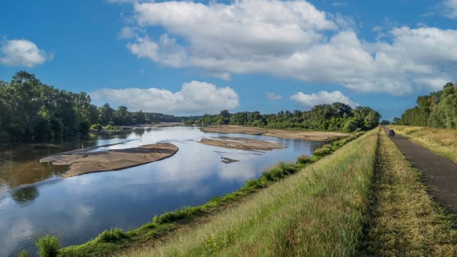
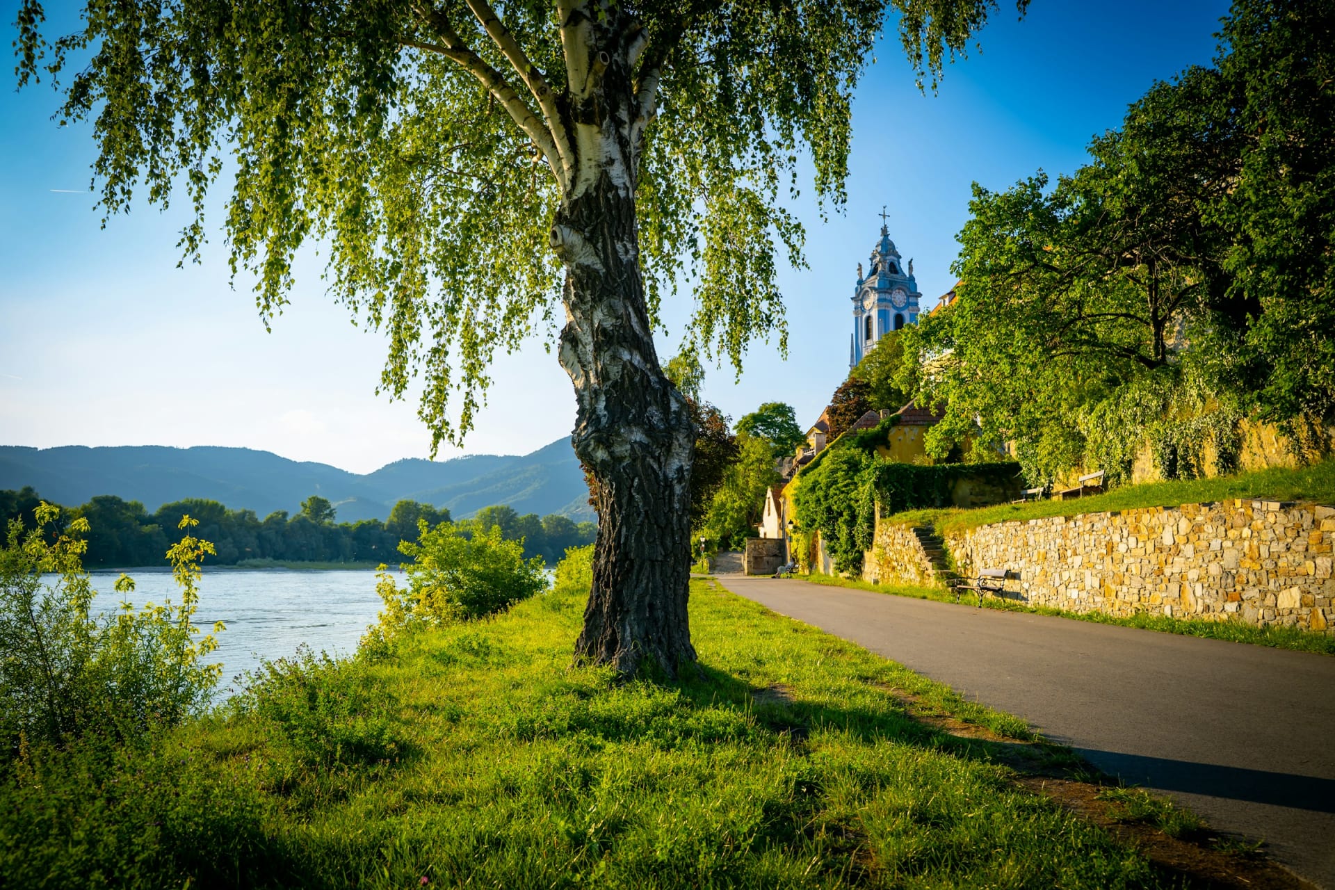
Tarmac cycle path along the Danube with a church tower behind the trees

Cycling in Europe

Danube Cycle Path: Passau to Vienna, stage by stage

The river flows the way you ride, and in a week you barely climb anything taller than a bridge ramp. Passau to Vienna is the busiest stretch of the Donauradweg. This is how to make it feel quieter than it is.

17 November 20269 min read

© Scorn Pion / Unsplash

Early morning in Spitz, and the little roller ferry to Arnsdorf is waiting at the jetty. It crosses whenever someone turns up, and the trip takes five to seven minutes. On the far bank a tarmac path runs between vineyards and the water all the way towards Krems. By mid morning it will be lined with e-bikes and tour groups in matching helmets. For now, it is yours.

The Donauradweg, or Danube Cycle Path, runs 2,850 km from Donaueschingen in Germany to the Black Sea. The Austrian section from Passau to Vienna is the part almost everyone rides, and for good reason. It is gently downhill, with a new town every night and someone else to carry your bags. What separates a good week from a tiring one is when you ride, which bank you choose and if your train home is booked.

The short answer

  • Flat or hilly: Practically flat. The river drops about 140 metres over the whole route, and the few short climbs are ramps onto dykes and bridges.

  • Distance: Roughly 320 to 330 km from Passau to Vienna, usually ridden in six to eight days with stages of 36 to 65 km.

  • Traffic: Mostly dedicated cycle path or quiet lanes. The main exceptions are short stretches beside main roads, especially on the north bank of the Wachau.

  • Crowds: Lower Austria, including the Wachau, carries the most bikes. July, August and weekends are the busiest.

  • Where to stay: Bett+Bike hotels by the river, with locked bike storage and help booking the next night.

The Danube Cycle Path at a glance

Passau to Vienna
c. 320-330 km sources range from 317 to 333 km
Total height loss
c. 140 m downhill, Passau to Vienna
Vienna above sea level
158 m Passau sits at around 300 m
Typical trip
6-8 days stages of 36-65 km
Whole Donauradweg
2,850 km Donaueschingen to the Black Sea
Bett+Bike stays
c. 50 in Upper and Lower Austria
Spitz-Arnsdorf ferry
all year weekdays only, November to February
Automatic bike counters
17 between Passau and Vienna
Bikes on intercity trains
reservation compulsory on ÖBB long-distance trains

Last checked:

Chapter 1 · Passau

c. 300 m

above sea level in Passau, the highest point of the trip

Signs from the town hall

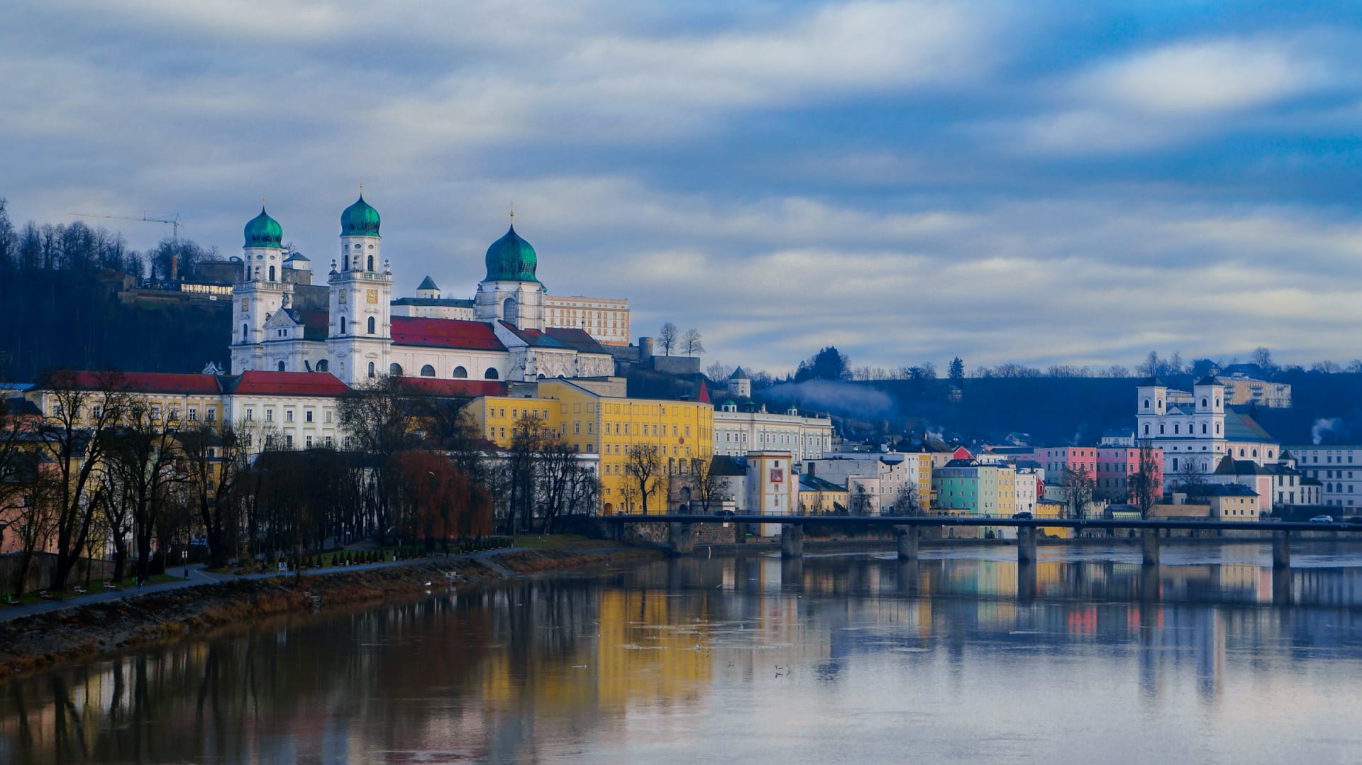
From the town hall square in Passau you follow signs marked «Donauroute» out of town. For the first days there is a cycle route on both banks, and small ferries let you switch sides when you like.

Passau old town and the green domes of St Stephen's Cathedral above the river

Chapter 2 · Melk

c. 36 km

from Melk to Krems through the Wachau

The abbey on the hill

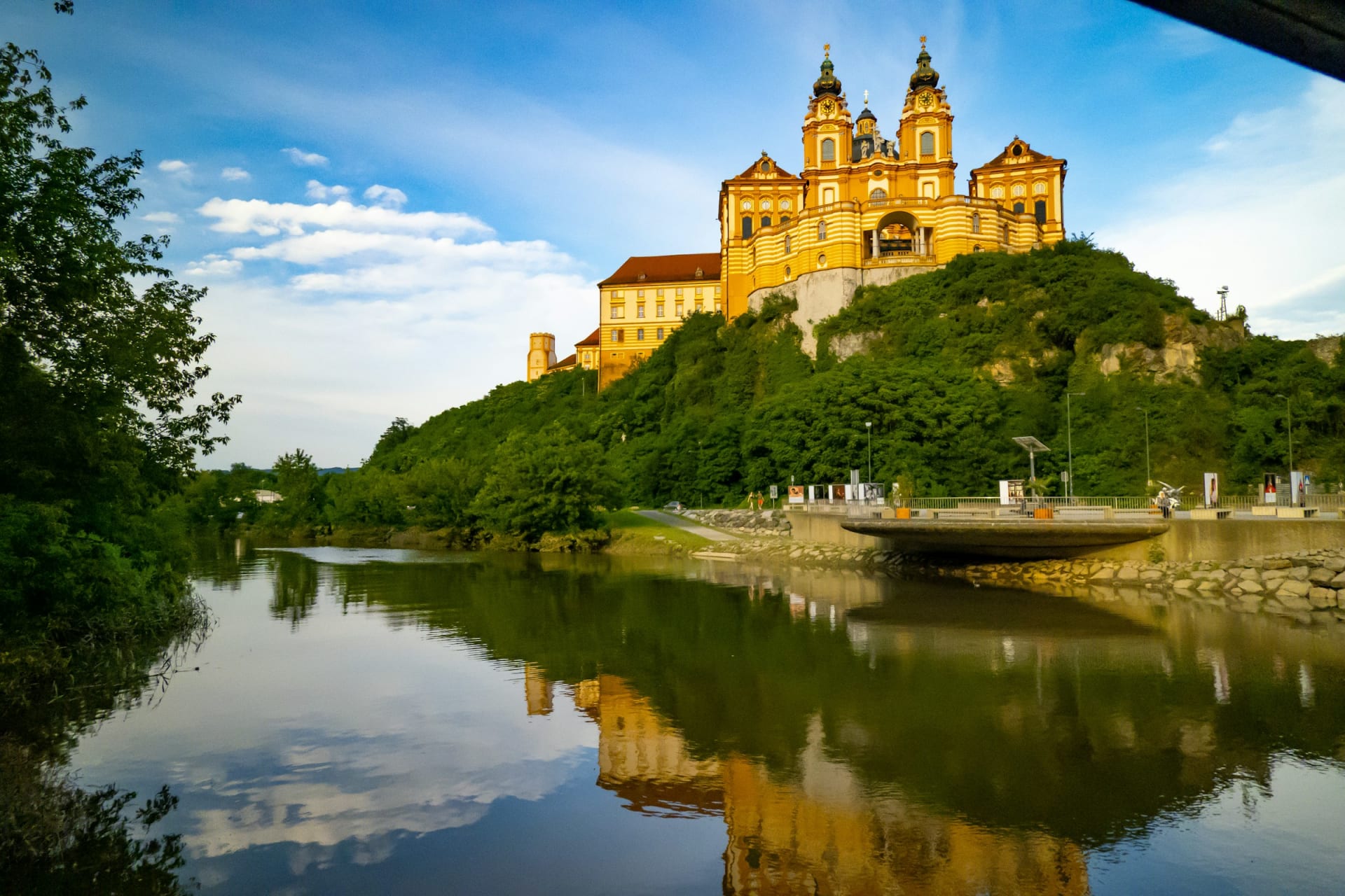
Melk Abbey sits high and yellow above the Danube and marks the start of the Wachau. From here to Krems is only about 36 km, yet it is the stretch most riders remember.

Melk Abbey on its hill, reflected in the water below

Chapter 3 · Wachau

5-7

minutes across on the Spitz-Arnsdorf ferry

Crossing by ferry

In the Wachau you ride both banks. Ferries link Spitz and Arnsdorf, Weißenkirchen and St. Lorenz, and Rossatzbach with Dürnstein. Only the Spitz-Arnsdorf crossing runs all year.

Dürnstein with its blue church tower and castle ruin, seen from the Danube

Chapter 4 · Vienna

158 m

above sea level in Vienna

Lower than you started

Rolling into Vienna, you are around 140 metres lower than in Passau. That is the whole secret of the route's popularity: the river does the climbing for you, and you supply the miles.

The Ringstrasse in Vienna early in the morning with trees along the street

Flat, but not dull

Few long-distance rides in Europe ask so little of your legs. The Austrian tourist board describes the daily stages of 40 to 70 km as mostly flat and downstream. One Upper Austria package lists 160 to 280 metres of climbing on most days, which comes from dyke ramps and a handful of short rises on the north bank, not mountains.

What makes the days long is time in the saddle and the occasional headwind. If your riding is mostly the commute, add a rest night in Linz or Krems and keep stages to 40 or 50 km.

The first section, Passau to Linz, is the wildest. The river cuts a deep, wooded valley, and at Schlögen it almost doubles back on itself in the Schlögener Schlinge, a bend of roughly 180 degrees. The north-bank path stops short here, so a small boat carries you on. The hotel at the Schlögen jetty runs the bike ferry across to Au itself.

Terraced vineyards above the Danube in the WachauZsolt Cserna / Unsplash
The WachauThe terraced valley between Melk and Krems is a UNESCO World Heritage landscape.

The profile

One very long, very gentle descent

There are no climbs worth naming on the Danube Cycle Path. The profile shows why: from Passau to Vienna the route loses about 140 metres over more than 300 kilometres.

Descent · Light traffic

Passau to Vienna: 0.04 per cent on average

The average gradient is too small to feel. What you will feel is an easterly headwind on poor days, and a few short ramps up to dykes and bridges.

From / To
Passau 300 m → Vienna 158 m
Length
317 km
Average
0.04 %

Suggested itineraries

Seven days: the classic

Passau to Schlögen 43 km, Schlögen to Linz 57 km, Linz to Grein 61 km, Grein to Melk 51 km, Melk to Krems 36 km, Krems to Tulln 47 km and Tulln to Vienna 38 km. The short day sits in the Wachau, which is where you will want to stop most.

Six days: built for e-bikes

Merge the middle into Grein to Spitz (65 km) and Spitz to Tulln (61 km). Stages have grown longer in recent years, largely because more people ride with a motor.

The Wachau only: a long weekend

Take the train to Melk, ride the south bank to Krems and come back along the north bank. That is around 70 km for the round trip, with a ferry at each end. It is the busiest part of the route, but it also has the most wine taverns per kilometre.

Luggage and the train home

Most packages include daily luggage transfer between hotels, usually one bag of up to 25 kg per person. Several hotels on the route offer the same for a fee if you book independently.

The train home is the part people forget. Westbound intercity trains from Vienna, Railjet and ICE, carry bikes only with a bike ticket and a compulsory bike-space reservation. Spaces are limited and can be booked up to six months ahead. Regional trains between Linz and Passau have room for 10 to 20 bikes.

PassauSchlögen311 mLinz268 mMelk226 mKrems197 mVienna192 m

Simplified map. Colour shows traffic: green light, amber moderate. Distances follow the Radler-Rast stages and are approximate.

The route

Passau to Vienna in five legs

Scroll to ride downstream.

  • Bike
  • Light traffic
  • Some traffic

Bike · c. 43 km · 309 → 311 m · Light traffic

Down the valley to the Schlögen bend

Cycle path on both banks and hardly any cars. Ferries at Obernzell and Schlögen let you change sides.

  • Cycle path
  • Ferry

Bike · c. 57 km · 311 → 268 m · Some traffic

Into Linz

City traffic builds towards the end. Between Puchenau and Linz the route has had its own cycle path since 2018.

  • Cycle path
  • City

Bike · c. 112 km · 268 → 226 m · Light traffic

Via Grein to Melk

The longest and quietest section, usually split over two days with a night in Grein. At Persenbeug the route crosses the river over the power station.

  • Dykes
  • Quiet

Bike · c. 36 km · 226 → 197 m · Some traffic

Through the Wachau

Pick the south bank for the views or the north bank for the wine villages. Parts of the north-bank route share the B3 main road.

  • Vineyards
  • Ferries

Bike · c. 85 km · 197 → 192 m · Some traffic

Via Tulln to Vienna

Flat dyke paths across the Tullnerfeld plain into the city. Tired legs can take the train from Tulln with the bike.

  • Dykes
  • Train

Which bank, and where the cars are

  • Passau to Linz: Signed on both banks. Small ferries at Obernzell, Schlögen and Ottensheim let you switch. Very little motor traffic.

  • Linz to Melk: Mainly the south bank as far as Persenbeug, where you cross over the power station to the north side. Long, quiet runs on dykes.

  • Wachau, south bank: Melk, Schönbühel, Aggsbach, Rossatz and Mautern, about 33 km, with wide views across the valley.

  • Wachau, north bank: Emmersdorf, Spitz, Weißenkirchen, Dürnstein and Krems, about 34 km. This is the wine-village side, but parts of it share the B3 main road. At Willendorf the route turns off onto the quieter L7140.

  • Tulln to Vienna: Flat dykes into the city, and trains from Tulln take bikes if you want to skip the suburbs.

Crowds and timing

ARGE Donau Österreich counts riders with 17 automatic counters between Passau and Vienna, and three quarters of the traffic is in Lower Austria, from Grein eastwards. Package tours run from late April to late October. For a quieter path, go in May or September, start early and skip the Wachau on Saturdays.

An honest warning about the Wachau

In June 2024 a rockfall at Aggsbach Dorf buried the B33 road and the south-bank cycle path. The section stayed shut for months, with a ferry and shuttle bus carrying riders round it. In February 2026 the B33 closed again for stabilisation work. Check with the Lower Austria authorities before planning the south bank between Melk and Rossatz. The north bank is the fallback.

Dürnstein Abbey on the rock above the DanubeMonika Fuchs / Unsplash
DürnsteinThe bike ferry from Rossatzbach lands you here from the south bank.

Frequently asked questions

How long does it take to cycle from Passau to Vienna?

Most people take six to eight days for the roughly 320 km. Longer six-day plans suit e-bikes, but the Wachau deserves a slow day.

Is the Danube Cycle Path suitable for beginners?

Yes. It is almost flat and mostly on traffic-free path, so the main challenge is daily distance rather than gradient.

Do I need to book luggage transfer?

Not if you are happy with panniers, but it helps. Most packages include it, and several hotels on the route arrange it for independent riders.

Can you take bikes on the Danube ferries?

Yes, the river ferries on the route are built for cyclists. Some run only in season, and services can stop when the water is very high or very low.

Which direction should I ride the Danube Cycle Path?

Passau to Vienna. You ride with the current and slightly downhill, and finish in a city with good rail links onwards.