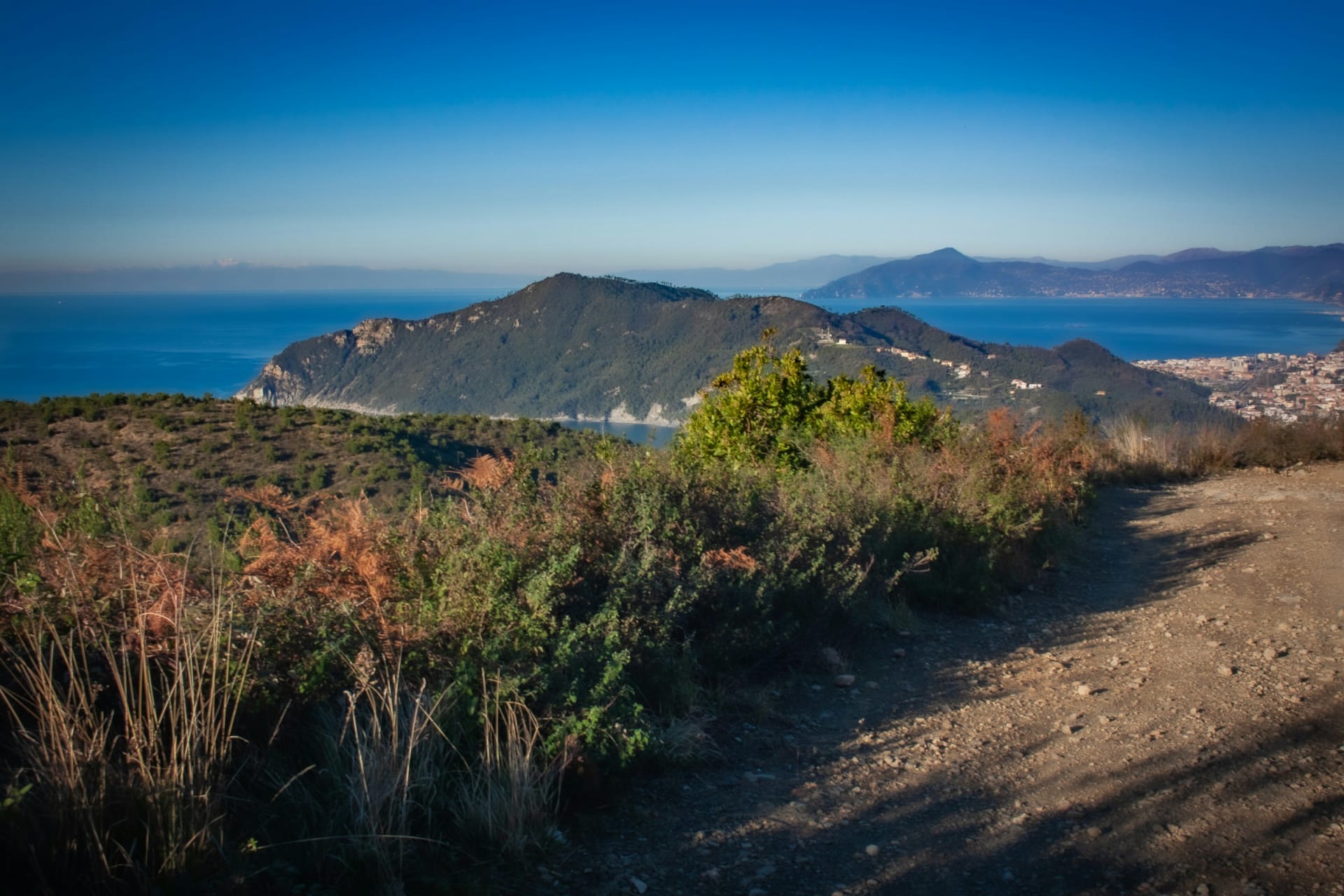
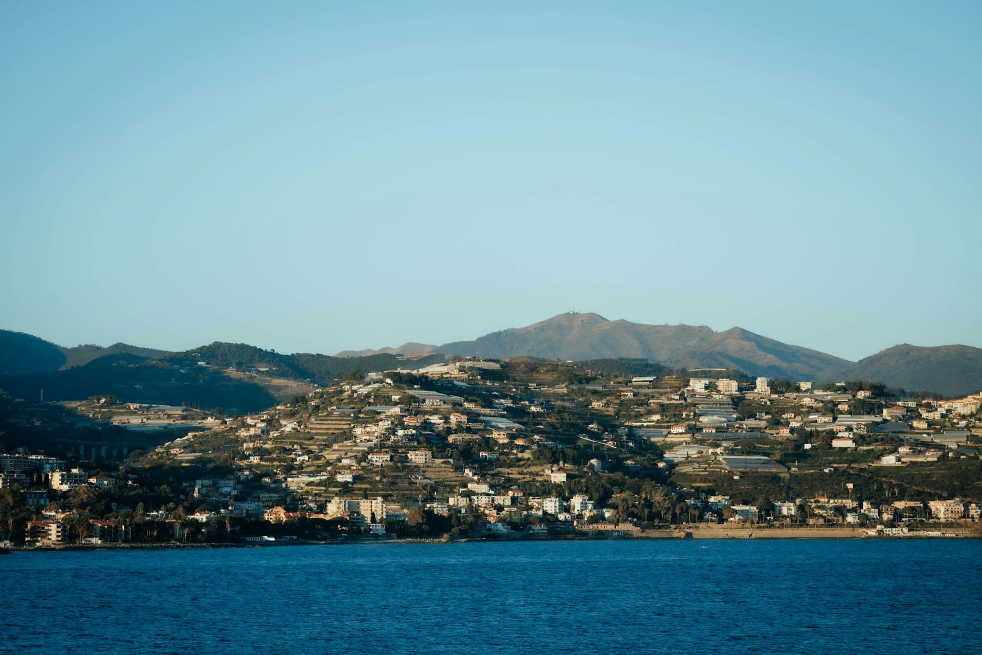
The coast at Sanremo with houses on the hills above the sea

Cycling in Italy

Cycling Liguria: the Sanremo coast, the Poggio and the quiet hills

The old coastal railway is now a flat, traffic-free path, and right above it are the climbs that settle Milan-San Remo every spring. How to ride the Italian Riviera, and where to avoid.

15 November 20269 min read

© meliston pinto / Unsplash

January, on the path between Sanremo and Arma di Taggia. The sea is on your right, and two riders in team kit overtake on their way to the Cipressa. The path is flat because it used to be a railway. Nothing else around here is.

The Riviera dei Fiori, the Riviera of Flowers, is the westernmost stretch of Liguria, from Imperia to the French border at Ventimiglia. It offers two kinds of riding, one on top of the other: a car-free path anyone can manage, and steep roads into the hills that professionals have trained on for decades. In between runs the Via Aurelia, the coast road to avoid.

The short answer

  • Flat: the cycle path on the old railway line, now about 45 km without a break from Ospedaletti to Andora.

  • Steep: everything above it. The Poggio and Cipressa are short; inland climbs such as Monte Bignone are long.

  • Traffic: the Via Aurelia (SS1) along the coast is narrow and busy. The inland roads are quiet.

  • Season: mild winters mean you can ride the coast for much of the year. The mountain roads behind are best from April.

  • Where to stay: Sanremo for restaurants and evenings, Santo Stefano al Mare to sleep beside the path.

Liguria by bike at a glance

Seaside cycle path
About 45 km Ospedaletti to Andora, continuous since 2026
Path terrain
Flat former railway line
The railway
1872 to 2001 moved inland, the trackbed became the path
Poggio
169 m 4 km at 3.7%
Cipressa
About 240 m 5.6 km at 4.1%
Monte Bignone
1,299 m the road from Sanremo climbs to about 1,200 m
Busiest road
Via Aurelia (SS1) coast road, no bike lane
Season
Year-round on the coast mountains best from April

Last checked:

Chapter 1 · The railway

2001

the last train along the beach

From train track to bike path

The Genoa to Ventimiglia line ran along the shore from 1872. In 2001 the tracks moved into tunnels inland, and the old route slowly became a cycle path. The tunnel at Capo Nero is almost 1.7 km long.

A gravel track with a view of the sea near Sestri Levante in Liguria

Chapter 2 · The gap closes

45 km

of continuous cycle path

45 kilometres without cars

For years the path ran 24 km, from Ospedaletti to San Lorenzo al Mare. In May and June 2026 the final links opened towards Imperia, Diano Marina and Andora.

Chapter 3 · La Primavera

1960

the Poggio's first year in the race

The Poggio, since 1960

Milan-San Remo is the longest one-day race on the professional calendar, and it is often decided on a climb only four kilometres long. The Poggio joined the route in 1960, the Cipressa in 1982.

Sanremo with the church on top of the hill above the town

Chapter 4 · January

2026

Pogačar spotted on the path in January

Where the pros ride in winter

In January 2026 Tadej Pogačar was spotted on the cycle path between Sanremo and Imperia. Mild winters make this coast a training ground while the Alps are shut.

Flat or hilly?

Both, stacked on top of each other. The seaside path is flat because it follows the old railway. Everything above it climbs: the Cipressa is 5.6 km at 4.1% from San Lorenzo al Mare, the Poggio about 4 km at 3.7%, and the road from Sanremo towards Monte Bignone 18.6 km at an average of 6.4%. Away from the path, flat kilometres are hard to find in this part of Liguria.

The seaside cycle path

The old Genoa to Ventimiglia railway ran on a narrow ledge between the hills and the sea. When the line moved into a tunnel in 2001, the coastal trackbed was left empty. From 2008 it was rebuilt as a path for cycling and walking, first the 24 km between Ospedaletti and San Lorenzo al Mare. In 2025 it won Italy's Green Road Award.

The last pieces arrived in 2026. The stretch around the Golfo Dianese between Diano Marina and Andora opened in May, and the link between Imperia and Diano Marina in June. You can now ride about 45 km without cars. The path is flat and surfaced, with long tunnels, the longest at Capo Nero at almost 1.7 km. Bikes and e-bikes can be hired along the way.

An honest caveat: this is not a training road. It is busy with walkers, pushchairs and families, especially at weekends and through the towns. If you want to ride at pace, use it early in the morning to get out of town, then head for the hills.

Winter riding on the Riviera

Western Liguria has a Mediterranean climate with mild winters. The German cycling magazine TOUR says you can ride the coast from February, while the mountain roads behind only become pleasant in April. Rain and wind still arrive here, so pack a waterproof.

A path leading down to the village of Cipressa in Liguria at duskChris Weiher / Unsplash
CipressaThe village sits at about 240 metres, 5.6 km up from the beach at San Lorenzo al Mare.

The climbs

Three climbs above Sanremo

Two short climbs from Milan-San Remo and one long one into the mountains. Scroll to ride the profiles.

Cipressa from San Lorenzo al Mare · Light traffic

Cipressa: straight up from the sea

It starts at sea level. About four steady kilometres take you to Costarainera, then the road eases along a balcony above the sea. The descent towards Aregai is steep, twisting and unforgiving.

From / To
San Lorenzo al Mare 5 m → Cipressa 240 m
Length
5.6 km
Average
4.1 %

Poggio di Sanremo · Some traffic

The Poggio: four kilometres that settle a race

From the Via Aurelia east of Sanremo the road winds up to the village of Poggio. The average is only 3.7%, the steepest ramps around 7%. From the top, about 7 km of twisting descent leads to the finish on Via Roma.

From / To
Via Aurelia 20 m → Poggio 169 m
Length
4 km
Average
3.7 %
Max
7 %

Monte Bignone from Sanremo · Light traffic

Monte Bignone: Sanremo's mountain

From the centre of Sanremo the road climbs past San Romolo towards Monte Bignone. Climbfinder counts 31 hairpins over 18.6 km. It gets quiet fast.

From / To
Sanremo 10 m → Monte Bignone 1,206 m
Length
18.6 km
Average
6.4 %
Hairpins
31

Recommended routes

Easy: the cycle path from Ospedaletti

Flat along the sea for as long as you like. The full path is about 45 km one way to Andora. Turning at San Lorenzo al Mare gives a round trip of about 48 km.

Moderate: the Milan-San Remo finale

From Sanremo along the path to San Lorenzo al Mare, up the Cipressa, along the Aurelia to the Poggio and down to Via Roma. Half a day, with two short climbs.

Hard: Monte Bignone

From Sanremo past San Romolo towards Monte Bignone, 18.6 km and about 1,200 metres of climbing. Take a windproof: the top is more than 1,200 metres above the beach you left.

OspedalettiArma di Taggia4 mSan Lorenzo al Mare9 mCipressa214 mPoggio87 mSanremo, Via Roma22 m

Simplified map. Colour shows traffic: green light, yellow moderate, red heavy.

The route

The Milan-San Remo finale from the cycle path

Flat along the sea on the path, then home over the Cipressa and Poggio the way the race does it. Scroll to ride the loop.

  • Bike
  • Light traffic
  • Some traffic
  • Heavy traffic

Bike · 12 → 4 m · Light traffic

Through Sanremo on the path

The path runs through the Capo Nero tunnel and past Sanremo's harbour. Watch for walkers in town.

  • Cycle path
  • Tunnels

Bike · 24 km from Ospedaletti · 4 → 9 m · Light traffic

End of the original path

The path used to stop here. Now you can carry on to Imperia, or turn for the climbs.

  • Cycle path
  • Flat

Bike · 5.6 km · 9 → 214 m · Light traffic

Up from the sea

A quiet road up to the village. Take the descent to Aregai carefully.

  • Climb
  • Technical descent

Bike · 214 → 87 m · Heavy traffic

The Aurelia, then the Poggio

The stretch from Cipressa to the Poggio is on the Via Aurelia, the busiest road on the coast. Ride it early, or drop back onto the path.

  • SS1
  • Heavy traffic

Bike · about 7 km · 87 → 22 m · Some traffic

Down to the finish

The twisting descent into town, and an espresso where the race ends.

  • Descent
  • Town traffic

Quiet roads and roads to avoid

  • Busy: the Via Aurelia, state road SS1, is the only road along the coast. It is narrow, has no bike lane and carries traffic most of the day. Short sections are often unavoidable, such as between Aregai and the Poggio, but do not plan long stretches on it.

  • Quiet: one valley inland, traffic drops away. The roads up to the Cipressa, the Poggio, San Romolo and the hill villages are calm outside rush hour.

  • Technical: the Cipressa descent is steep and narrow, and olive residue can make it slippery in autumn.

Getting there

The nearest major airport is Nice, just over the French border. Genoa is further east. The coastal railway between Genoa and Ventimiglia still runs, now through the tunnels inland. For the wider picture of where to ride in Italy and when, see our guide to cycling holidays in Italy.

The harbour in Sanremo with boats and the town on the hillside behindViktor Hesse / Unsplash
SanremoThe town where Milan-San Remo finishes, and where the cycle path runs past the harbour.

Where to stay

Cycle-friendly hotels in Liguria

Stay beside the path if you want to roll out of the door, or in Sanremo if the evenings matter as much as the riding.

Picolo-redaksjonen

Picolo-redaksjonen · Updated 15 Nov 2026

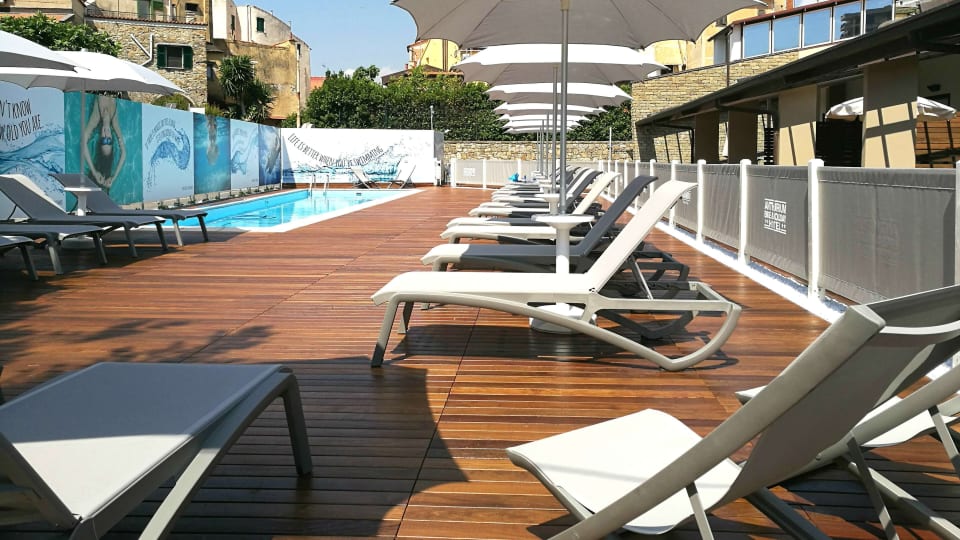
The pool terrace with sun loungers at Best Western Hotel Anthurium in Santo Stefano al Mare

Santo Stefano al Mare

1. Best Western Hotel Anthurium

  • Guided rides
  • On the path

The hotel runs the Sanremo Bike Hotel programme, with guided rides and training plans for road cyclists. The cycle path starts just outside, and the Cipressa is close by.

Best for: Road riders who want a guide

The pool among palm trees with the sea behind at Royal Hotel Sanremo

Sanremo

2. Royal Hotel Sanremo

  • E-bike
  • Bike hire
  • Central

A large, classic hotel in Sanremo. It has e-bike charging points and offers bike hire and rides. Ask about storage if you are bringing your own road bike. Best for riders who want the cycle path by day and restaurants by night.

Best for: Couples who want the town and an e-bike

How Picolo chooses

Our editors pick every hotel and experience themselves, and most of them we have tried. Nobody can pay to be included or ranked higher. When you book through our links, Picolo earns a small commission. It never changes the price you pay, and it never decides what we write.

Frequently asked questions

Is the Sanremo cycle path flat?

Yes. It follows the old railway along the sea and is almost completely flat.

Can you hire bikes in Sanremo?

Yes, there are hire points along the cycle path with both standard bikes and e-bikes.

How long is the Poggio climb?

The Poggio is about 4 km at an average of 3.7%, topping out at 169 metres.

Is Liguria good for winter cycling?

The coast has mild winters and riders train here from January. The mountain roads inland can be cold and wet, and are at their best from April.

Where should I stay for cycling in Liguria?

Santo Stefano al Mare and San Lorenzo al Mare sit in the middle of the cycle path and close to the Cipressa. Sanremo suits you if you want more restaurants and life in the evening.