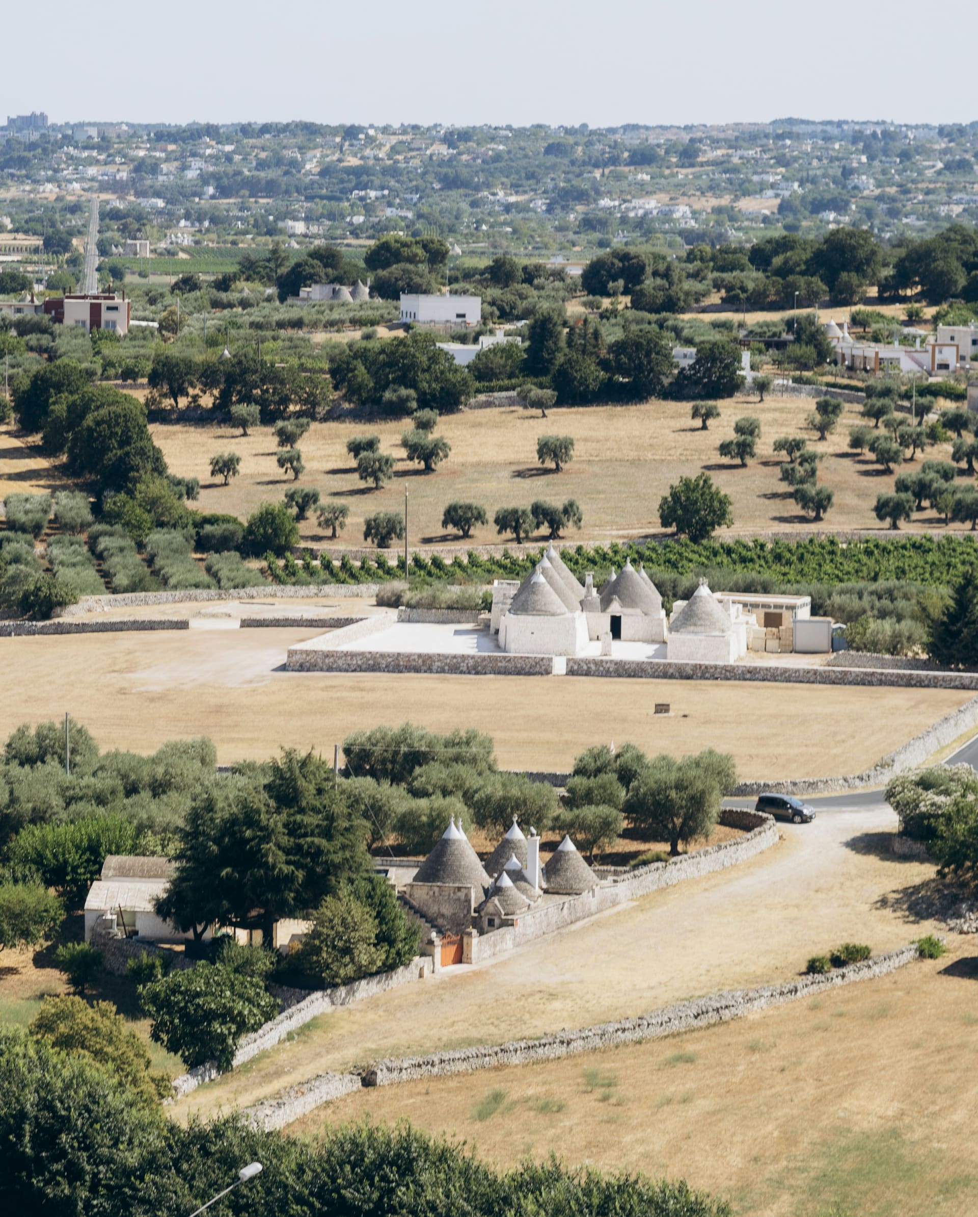
Trulli and dry stone walls among olive trees near Locorotondo in the Valle d'Itria

Cycling in Italy

Cycling in Puglia: the Valle d'Itria, trulli villages and the far south

The lane is barely wide enough for one car, and none comes. Just dry-stone walls, olive trees and another cone-roofed trullo at every bend. Puglia is the flattest region in Italy. The wind off the sea has not been told.

15 November 20269 min read

© Tania Lyahnovich / Unsplash

Mid-morning near Cisternino, and the only sound is a tractor two fields away. The road runs between knee-high walls of pale limestone, stacked without mortar, and behind them the grey cones of the trulli poke up between the olive trees.

Puglia is the heel of Italy, and most of it is plain or low hills. That makes it a good choice for a mixed group: different fitness levels, e-bikes, teenagers who would rather not climb. But flat is not the same as easy. The Valle d'Itria is all short, constant rises, and down on the coast the wind decides how hard your day will be. Climbers should look to Tuscany or the Alps.

The short answer

  • Flat or hilly: mostly flat to gently rolling. The Valle d'Itria sits on a plateau around 400 metres up, and the only serious climb is the escarpment above Fasano.

  • Traffic: the main coastal roads, the SS16 and SS379, are built for speed. The farm lanes inland are close to empty.

  • Wind: often a bigger opponent than any hill, especially in Salento. Check the direction before you choose a route.

  • When to go: April to June and September to October. July and August are hot and crowded.

  • Where to stay: a masseria, an old fortified farmhouse turned hotel, or Ostuni, Locorotondo or Lecce.

Puglia by bike at a glance

Plain
53% 45% low hills, only 1.5% mountain
Highest point in the region
1,151 m Monte Cornacchia, far north in Foggia
Locorotondo
410 m Cisternino 394 m, Alberobello 428 m
Steepest climb nearby
9.8% average up to Selva di Fasano, 411 m
Aqueduct cycle path open
c. 24 km Cisternino, Ceglie Messapica and Martina Franca
Main opponent
The wind above all in Salento and on the coast
Avoid
SS16 and SS379 the main Adriatic coast roads
Best months
April to June, September to October
Nearest airports
Bari and Brindisi Brindisi is closer to Salento

Last checked:

Chapter 1 · The heel

1.5%

of Puglia is mountain

A region without mountains

More than half of Puglia is plain and just one and a half per cent is mountain. Its highest point, Monte Cornacchia at 1,151 metres, is far to the north, hours from the lanes of the south.

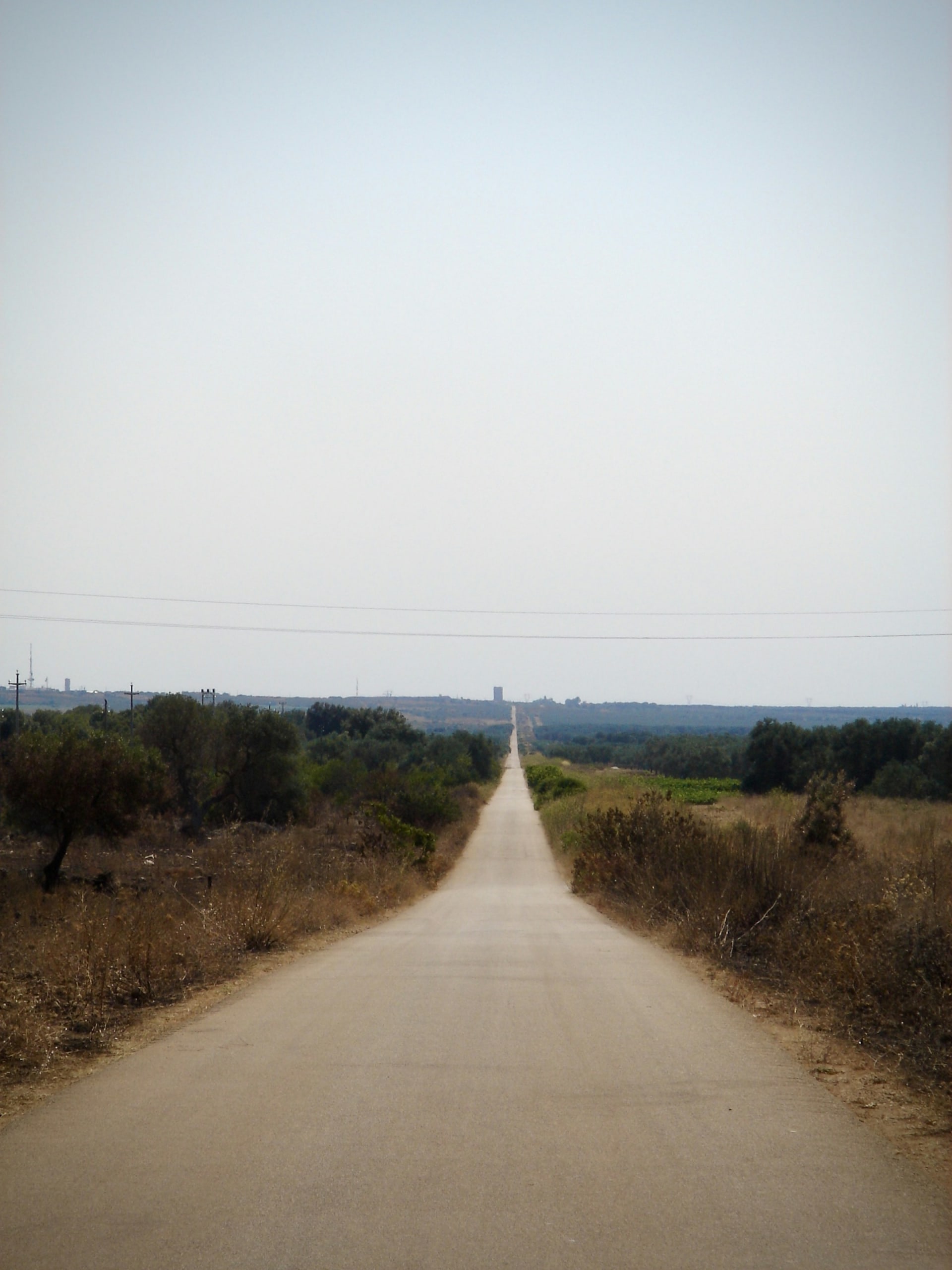
A long straight country road through dry scrub and low trees near Avetrana in southern Puglia

Chapter 2 · The trulli

1996

UNESCO World Heritage listing

Houses with stone cones

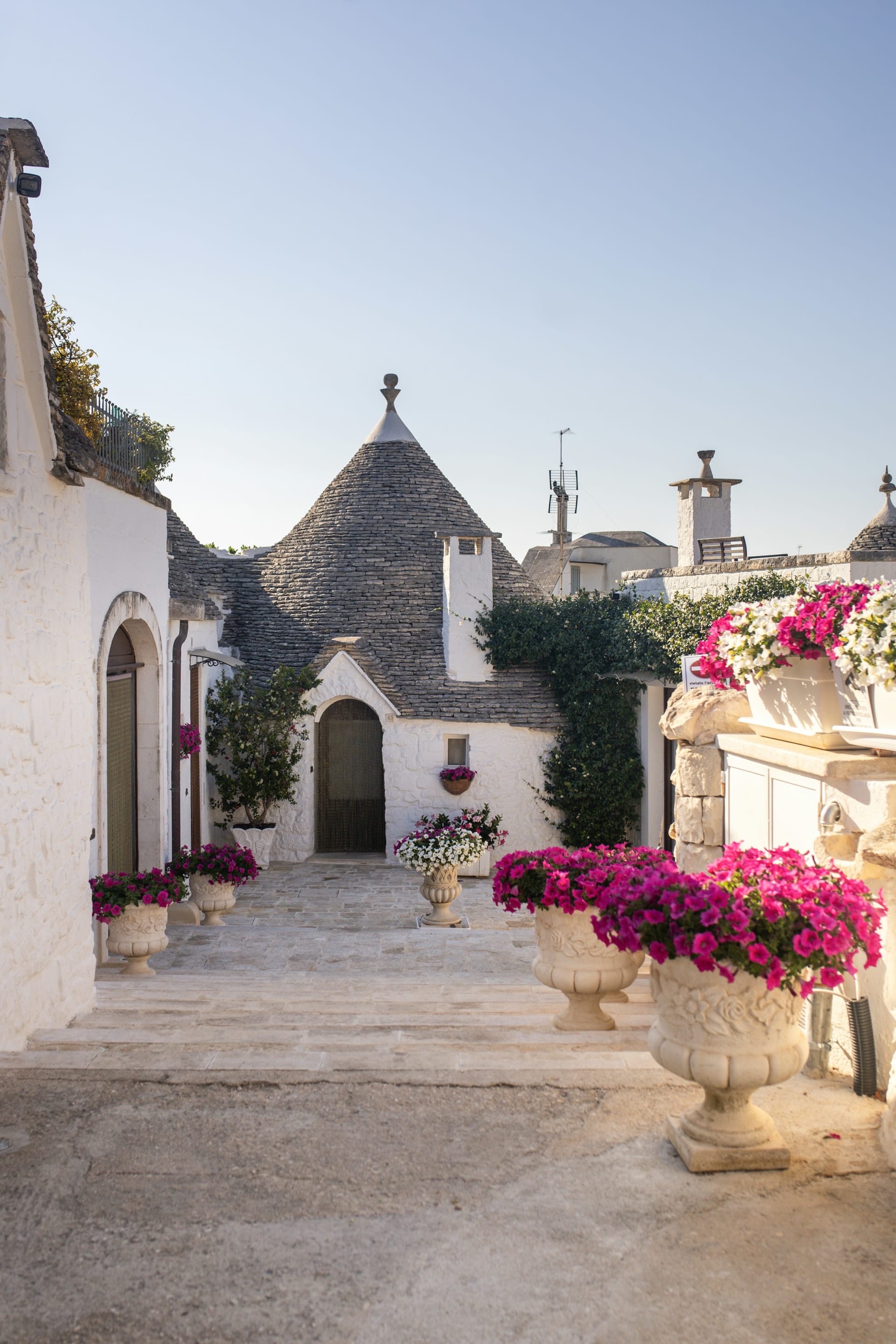
Trulli are dry-stone houses with conical roofs of stacked limestone. The trulli of Alberobello were inscribed by UNESCO in 1996. Arrive before the day-trippers, or ride on to Locorotondo, where it is quieter.

White trulli with conical stone roofs and pink flowers in Alberobello

Chapter 3 · The aqueduct

540 km

planned length of the full route

A cycle path on top of a river

The Acquedotto Pugliese carries water across the region. Its service road is being turned into a cycle path, planned eventually to run about 540 km from Campania to Santa Maria di Leuca.

A gravel track along a dry stone wall and olive trees near Cisternino in the Valle d'Itria

Chapter 4 · Land's end

60 km

Otranto to Leuca along the coast

The coast road to the tip of Italy

From Otranto the SP358 follows the cliffs south towards Santa Maria di Leuca, about 60 km of short, repeated climbs. At the end the Adriatic meets the Ionian Sea.

The Punta Palascia lighthouse on the rocky cliff coast south of Otranto in Salento

Flat or steep?

Flatter than the rest of Italy, but not pancake flat. Of Puglia's land, 53 per cent is plain, 45 per cent low hills and 1.5 per cent mountain. The Valle d'Itria is a plateau at about 400 metres: Cisternino stands at 394, Locorotondo at 410, Alberobello at 428 and Martina Franca at 431. Between them the rises are short and frequent, but rarely steep for long.

The one real wall is the escarpment between the coast and the plateau. From Fasano up to Selva di Fasano, at 411 metres, it is 2.7 km at an average of 9.8 per cent, or 3.9 km at 7.5 per cent if you take the road past the Zoosafari. Further south in Salento, Lecce sits at 49 metres and Otranto at 15, yet the coast road towards Leuca is a string of short climbs.

Ride the wind, not the map

Salento has little shelter, especially on the western side towards Gallipoli. A 100 km day with no hills can turn hard if the last 40 km are into a headwind. Check the forecast the evening before and plan for a tailwind home. In a strong sea wind, head inland.

The white old town of Ostuni on its hill with the coast in the distanceTania Lyahnovich / Unsplash
OstuniThe white town on its hill, with the coastal plain running down to the sea.

The climbs

Up the escarpment to Selva di Fasano

Puglia does have hills, just not many. The roads up from Fasano to the woods of Selva di Fasano are the steepest in this corner of the region.

Selva di Fasano via Viale delle Giritole · Light traffic

Eight bends up the escarpment

From Fasano the SP2 climbs 2.7 km to Selva di Fasano at 411 metres, averaging 9.8 per cent through eight hairpins. The steepest 100 metres are at 16.8 per cent. Short, and no time to warm up.

From / To
Fasano 148 m → Selva di Fasano 411 m
Length
2.7 km
Average
9.8 %
Max
16.8 %
Hairpins
8

Selva di Fasano via Zoosafari · Light traffic

The kinder way up

The road past the Zoosafari wildlife park is 3.9 km at an average of 7.5 per cent, with eight bends and one ramp of 12.7. Take this one if you would rather stay seated.

From / To
Fasano 119 m → Selva di Fasano 411 m
Length
3.9 km
Average
7.5 %
Max
12.7 %
Hairpins
8

Routes we would ride

Easy: Locorotondo, Cisternino and the aqueduct

A short loop from Locorotondo to Cisternino and out along the cycle path. Very little traffic, small rises and a coffee in every town.

Moderate: Ostuni, Cisternino and Locorotondo

A loop linking three of the Valle d'Itria towns is the classic introduction. Add Martina Franca for a longer day with more short climbs.

Hard: Otranto to Santa Maria di Leuca

The SP358 runs about 60 km south along the cliffs with countless short ascents. A loop from Otranto of around 100 km gathers roughly 900 metres of climbing. The wind will decide how hard it feels.

The Acquedotto Pugliese cycle path

The open section is in the Valle d'Itria, between Figazzano near Cisternino and Ceglie Messapica, with a branch towards Martina Franca: about 24 km in total. Four new sections, from the Basilicata border via Castel del Monte and Bitonto to Gioia del Colle and Cisternino, are meant to take it to about 192 km within Puglia. They were due for completion in 2026, but we could find no confirmation that they have opened, so check with Acquedotto Pugliese before planning around them.

OstuniCeglie Messapica306 mFigazzano341 mLocorotondo392 mAlberobello424 mSelva di Fasano322 mSavelletri0 m

Simplified map. Distances are approximate. Colour shows traffic: green light, yellow moderate, red heavy.

The route

A day across the Valle d'Itria

Scroll to ride from Ostuni, along the aqueduct and through the trulli towns down to the sea.

  • Bike
  • Light traffic
  • Some traffic

Bike · c. 13 km · 236 → 306 m · Some traffic

Out of the white town

Ostuni stands at 218 metres, Ceglie Messapica at 298. The road between them carries some traffic but is fine early in the day.

  • Country road
  • Gentle climb

Bike · c. 20 km · 306 → 341 m · Light traffic

Along the aqueduct

From Ceglie, follow the cycle path on the Acquedotto Pugliese service road north-west to Figazzano, near Cisternino. No cars at all.

  • Cycle path
  • Car-free

Bike · c. 5 km · 341 → 392 m · Light traffic

The round town

Locorotondo, at 410 metres, has an old centre built in a ring on top of its hill. The lanes around it run between vineyards and stone walls.

  • Stone walls
  • Wine

Bike · c. 9 km · 392 → 424 m · Some traffic

Trulli and tour groups

Alberobello is the best-known stop and the busiest. Get there before the day-trippers and you will have the streets largely to yourself.

  • Trulli
  • Tourist traffic

Bike · c. 12 km · 424 → 322 m · Light traffic

The edge of the plateau

Selva di Fasano sits at 411 metres where the plateau ends and the escarpment drops towards the sea. From here, it is all downhill.

  • Views
  • Descent

Bike · c. 12 km · 322 → 0 m · Some traffic

Down to the sea

Descend to Fasano and on to the coast at Savelletri, where several of the masserie are. Stay on local roads and keep off the SS379.

  • Coast
  • Masserie

Quiet roads and roads to avoid

  • Quiet: the narrow lanes between Locorotondo, Cisternino and Martina Franca. The countryside is threaded with small roads between farms, villages and olive groves, and most see little but tractors.

  • Busy: the SS379 between the Bari area and Brindisi is a dual carriageway, and ANAS has had roadworks on it for several years. The SS16 is the main road along the whole Adriatic coast. Neither is a place for a bike.

  • Around the cities: traffic builds quickly towards Bari, Brindisi and Lecce, and coastal towns such as Otranto and Gallipoli are packed in July and August.

  • Surfaces: minor roads can have potholes, cracks and grit left by farm vehicles. Tyres of 30 or 32 mm make for a kinder ride.

Hiring bikes and taking the train

Corte Altavilla in Conversano rents standard bikes and e-bikes, and several masserie lend bikes to guests. These are rarely road bikes, so if you plan to ride far, bring your own or book with a hire company in advance. Lecce has good rail links and is the easiest base in Salento without a car.

Good to know

  • Heat: in July and August start early and carry extra water. Small shops and cafés often close in the afternoon.

  • Lights: a daytime rear light helps on the long straight country roads.

  • Getting there: fly to Bari for the Valle d'Itria, or Brindisi for both the Valle d'Itria and Salento. Two bases, one in each, work well for a week.

A narrow road between dry stone walls and olive trees near Cisternino in the Valle d'Itria at sunsetLeandro Argentiero / Unsplash
The wallsLimestone walls, stacked without mortar, line the back roads of the Valle d'Itria.

Where to stay

Masserie and hotels for cyclists in Puglia

A masseria is an old fortified farmhouse, and many are now hotels. Not all of them are set up for cyclists, so always check for locked bike storage before you book.

Picolo-redaksjonen

Picolo-redaksjonen · Updated 15 Nov 2026

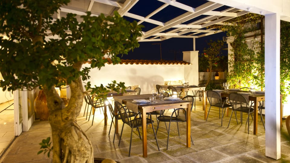
The rooftop terrace with an olive tree at Corte Altavilla in Conversano, Puglia

Conversano

1. Corte Altavilla

  • Bike room
  • Workshop
  • Bike hire

A hotel in the old centre of Conversano, south-east of Bari, that takes cyclists seriously. There is a bike room, a workshop, routes and maps, a cyclist's breakfast and both standard and electric bikes to rent. On request it can arrange bike washing, guides and a support van. The pick for anyone riding every day.

Best for: Riders who want a workshop and a guide

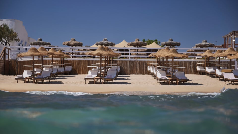
Sun loungers and parasols at the beach club of Rocco Forte Masseria Torre Maizza

Savelletri di Fasano

2. Rocco Forte Masseria Torre Maizza

  • Bikes
  • Olive groves
  • Coast

A masseria among the olive groves just inland from the coast at Savelletri. Guests can use the hotel's bikes, and it organises rides between the olive trees. Choose it for the recovery after the ride rather than the workshop.

Best for: Gentle rides through the olive groves

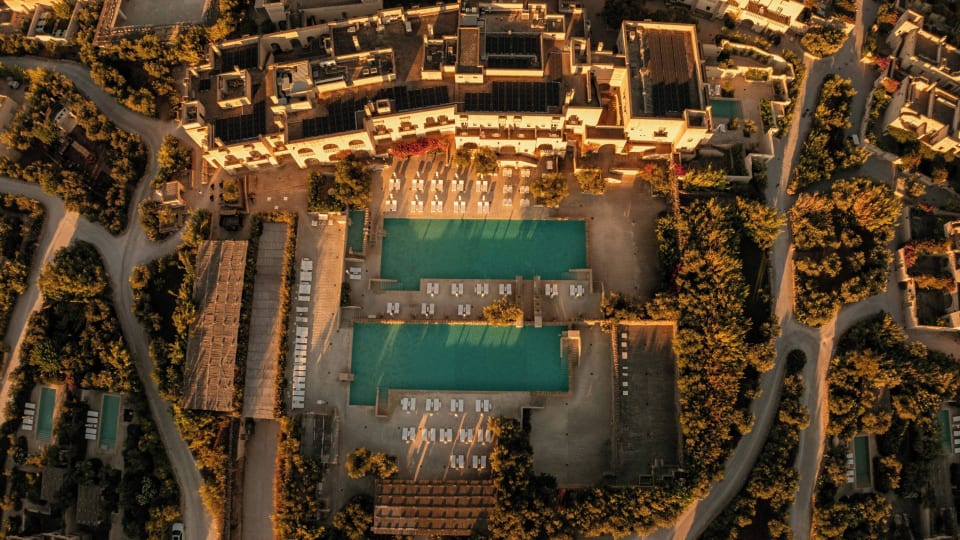
Aerial view of the pools and stone buildings at Borgo Egnazia in Fasano

Savelletri di Fasano

3. Borgo Egnazia

  • Bike hire
  • Beach
  • Families

A large resort built in the local style close to the sea, with bikes to rent. Guests like to ride through the golf course down to the beach. Selva di Fasano and the Valle d'Itria are within reach for a longer day, but this is a holiday with bikes rather than a cycling holiday.

Best for: Families and short rides

How Picolo chooses

Our editors pick every hotel and experience themselves, and most of them we have tried. Nobody can pay to be included or ranked higher. When you book through our links, Picolo earns a small commission. It never changes the price you pay, and it never decides what we write.

Frequently asked questions

Is Puglia flat for cycling?

Puglia is Italy's flattest region, but the Valle d'Itria has plenty of short rises. The steepest climb nearby, from Fasano to Selva di Fasano, averages close to 10 per cent.

How long is the Apulian Aqueduct cycle path?

The open section in the Valle d'Itria is about 24 km. The full route is planned at roughly 540 km, and the new sections in Puglia had not been confirmed open in November 2026.

Which airport is best for a cycling holiday in Puglia?

Bari suits the Valle d'Itria and the coast north of Brindisi. Brindisi sits between the Valle d'Itria and Salento.

Can you cycle in Puglia in summer?

Yes, but July and August are hot. Set off at sunrise, carry extra water and expect many cafés to close in the afternoon.

Do I need an e-bike in Puglia?

Most riders manage without one. An e-bike helps most in a headwind and on the climbs from the coast up to the Valle d'Itria.