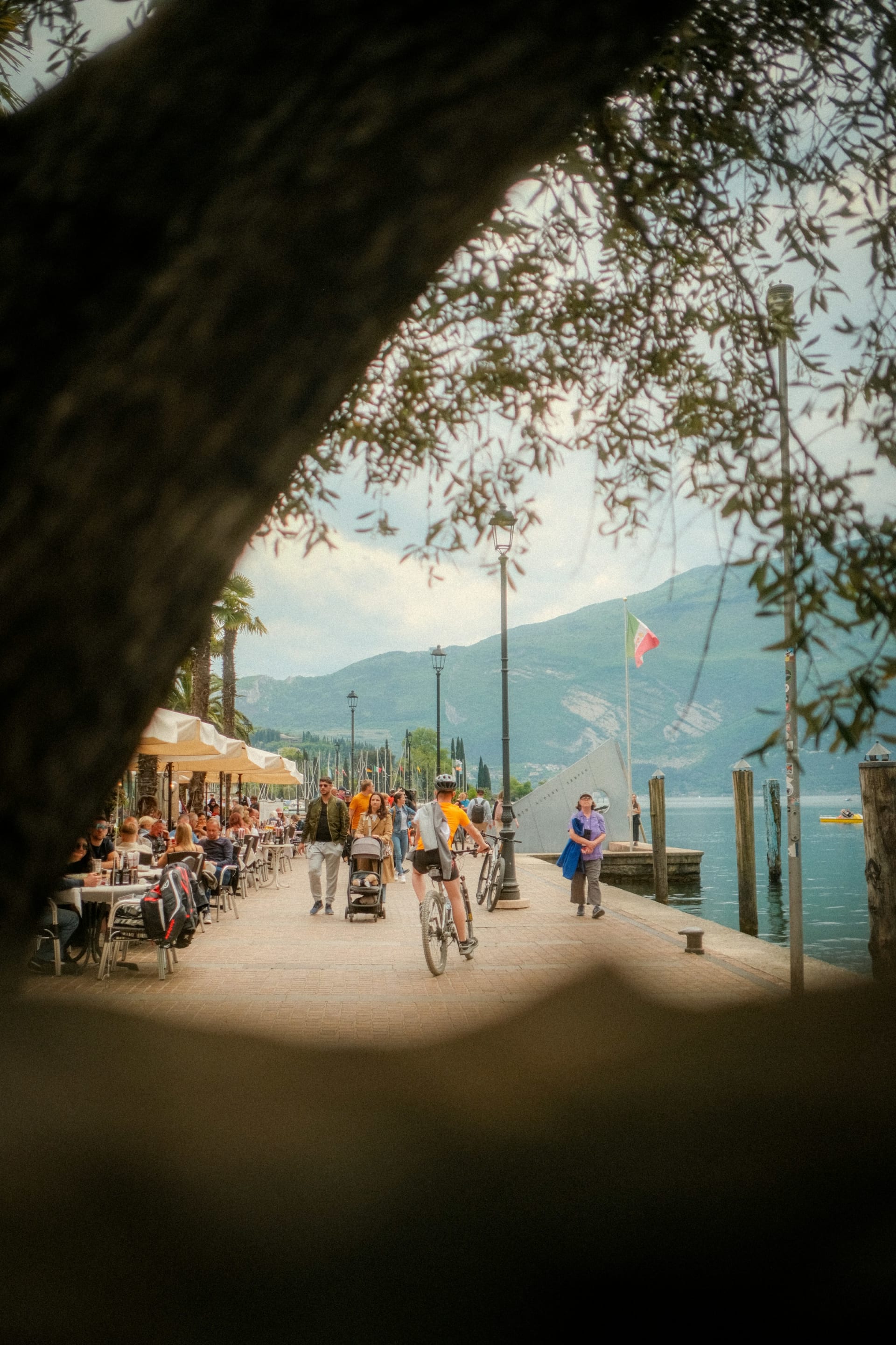
Cyclists and walkers on the lakeside promenade in Riva del Garda

Cycling in Italy

Cycling Lake Garda: where it is flat, where it climbs and which roads to skip

Early morning in Riva, the northerly wind at your back and the lake still glassy. By eleven, the same shore road is a queue of coaches and tunnels. Choose your half of the lake, and your hour, with care.

15 November 20269 min read

© Lurucrain / Unsplash

The cycle path from Riva to Torbole is almost empty just after seven. Monte Baldo still throws the eastern shore into shade, and the morning wind pushes south down the lake, which is the direction you want to be riding. Give it an hour and the cars, motorbikes and tour coaches will have the road.

Lake Garda is Italy's largest lake, and for a cyclist it is really two places. The southern end is open country: vineyards, low hills and a car-free path that follows a river all the way to Mantua. The northern end is a fjord in all but name, with mountains rising straight from the water, roads blasted through the rock and some of the steepest tarmac in Italy. The real question is which end suits you, and what time you set the alarm.

The short answer

  • Flat or hilly: Flat in the south, around Peschiera and Sirmione, where the Mincio cycle path runs almost 50 km to Mantua without cars. Steep in the north, where you can climb more than 1,000 metres from the lakefront.

  • Traffic: The two shore roads, the Gardesana Occidentale on the west and the Gardesana Orientale on the east, have tunnels, narrow stretches and heavy traffic from April to October and at weekends.

  • The full lap: 142.6 km and 1,592 metres of climbing on Visit Trentino's route. Not one for high summer.

  • When to go: Spring and autumn, ideally midweek. July and August are the busiest months on the roads.

  • Where to stay: Riva del Garda, Torbole or Arco at the northern tip, where the climbs start at the hotel door.

Lake Garda by bike at a glance

Lake level
65 m above sea level
Length of the lake
51.6 km Riva in the north to Peschiera in the south
Full lap
142.6 km 1,592 m of climbing on Visit Trentino's route
Highest point on the lap
291 m near Tignale, west shore
Steepest climb
12.7% average up Punta Veleno over 7.9 km
Car-free path
almost 50 km Peschiera to Mantua along the Mincio
Bikes on boats
Yes not on catamarans or fast boats
Busiest roads
April to October and every weekend
Deepest point
346 m between Tignale and Castelletto

Last checked:

Chapter 1 · The south

almost 50 km

of car-free path from the lake to Mantua

The flat half

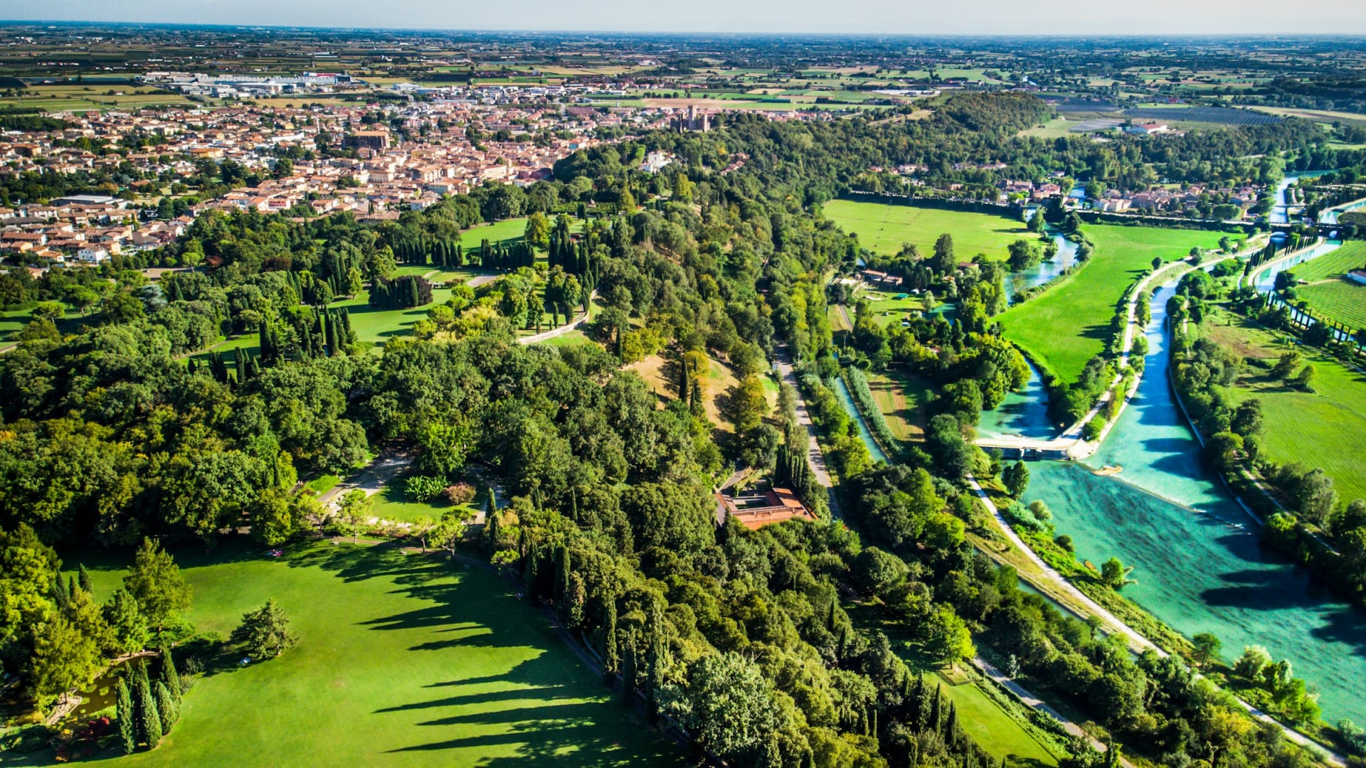
From Peschiera the cycle path follows the River Mincio south past Borghetto and Valeggio to Mantua. It is tarmac, separated from traffic and barely rises at all. This is where families and e-bikes belong.

The Mincio river through green countryside at Valeggio sul Mincio south of Lake Garda

Chapter 2 · The west shore

3 km

the Efialti tunnel on the SS45bis

A road through the mountain

The Gardesana Occidentale, the SS45bis, runs through tunnel after tunnel between Gargnano and Riva. By the road authority's own kilometre markers, the Efialti tunnel near Tremosine is about three kilometres long. Front and rear lights are compulsory.

The road along the steep cliffs above Lake Garda near Riva del Garda

Chapter 3 · Limone

2018

the year the cliff path opened

The path that hangs over the water

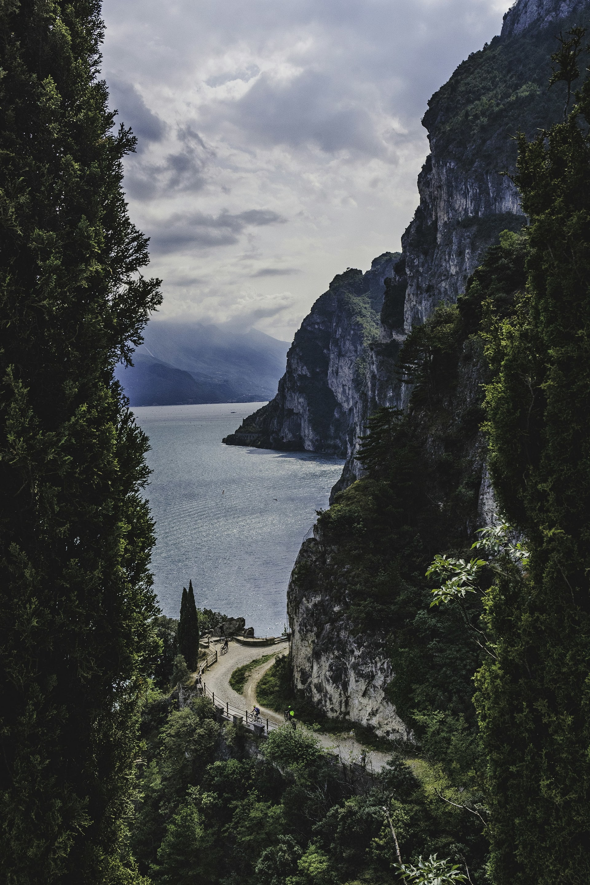
North of Limone, the cycle and footpath is bolted to the cliff for about two kilometres, from Capo Reamol to the Trentino border. It opened in July 2018, the first showpiece of a planned cycle route around the whole lake.

The suspended cycle path at Limone sul Garda

Chapter 4 · The east shore

20

hairpins up Punta Veleno

Twenty hairpins up Monte Baldo

From Castello di Brenzone a narrow lane climbs straight into the Monte Baldo massif to Punta Veleno: 20 hairpins, more than 1,000 metres of climbing and a 12.7 per cent average. The tourist office asks you to descend another way.

View over the northern end of Lake Garda towards Riva del Garda and Torbole

Flat or hilly

Lake Garda splits neatly in two. The southern end, around Peschiera, Sirmione and Desenzano, is open country with low hills, and the Mincio path runs almost 50 km to Mantua on tarmac with no cars. The northern end is mountain rising straight out of the water, and you will struggle to ride far there without climbing.

Three climbs show the range. Punta Veleno from Castello di Brenzone on the east shore is 7.9 km at an average of 12.7 per cent, with 20 hairpins and a summit at 1,135 metres. It is among the steepest paved roads in Italy, and the Malcesine tourist office asks riders not to descend it. Passo Santa Barbara from Bolognano near Arco is 13 km at 8.1 per cent through 25 forested bends, topping out at 1,174 metres. The Strada della Forra to Pieve di Tremosine is gentler: 5.3 km at 6 per cent, through a narrow gorge above the Gardesana.

The cliffs above Limone sul Garda in the northern part of Lake GardaPatrick Federi / Unsplash
The northern endHere the climbing starts at the lakefront.

The climbs

Three climbs that show how steep the north is

The northern half of the lake is climbing country. These three could hardly be more different, from a shaded forest road to one of the steepest paved climbs in Italy.

Punta Veleno from Castello di Brenzone · Light traffic

Punta Veleno: short and merciless

From the shore at Brenzone the road gains more than 1,000 metres in under eight kilometres. The steepest hundred metres have been measured at close to 25 per cent, and the surface is patchy. Descend via Prada, never the way you came up.

From / To
Castello di Brenzone 130 m → Punta Veleno 1,135 m
Length
7.9 km
Average
12.7 %
Max
24.8 %
Hairpins
20

Passo Santa Barbara from Bolognano · Light traffic

Santa Barbara: the long forest climb

From Bolognano, just outside Arco, the road winds through 25 bends and dense woodland to Passo Santa Barbara on Monte Velo. It averages 8.1 per cent, the shade makes it a good summer choice and traffic is light. Most riders descend towards Loppio.

From / To
Bolognano 117 m → Passo Santa Barbara 1,174 m
Length
13 km
Average
8.1 %
Max
13.2 %
Hairpins
25

Strada della Forra to Pieve · Some traffic

Strada della Forra: the gorge road at Tremosine

The Forra road leaves the Gardesana and squeezes into a narrow gorge before climbing steadily to Pieve di Tremosine. The gradient is gentle, but rockfalls have closed it for long spells. Since August 2025 the lower section has been one way, uphill only.

From / To
Porto di Tremosine 89 m → Pieve di Tremosine 408 m
Length
5.3 km
Average
6 %
Max
8.4 %

Routes we recommend

Easy: Peschiera to Mantua

Almost 50 km of tarmac path beside the Mincio, without cars and with hardly a rise. Stop at Borghetto sul Mincio on the way and have lunch in Mantua.

Moderate: the northern loop by boat

Riva, Torbole, Malcesine, the ferry to Limone, the cliff path and back to Riva. A short day in the saddle, but you see both shores and ride the path over the water. Start early to have the Gardesana Orientale before the coaches.

Hard: the whole lake

Visit Trentino's lap of Lake Garda is 142.6 km with 1,592 metres of climbing. The high point is only 291 metres, near Tignale, yet the road rarely stops rising and falling and many of the tunnels are long. Ride it in March, early April or October, on a weekday.

One honest caveat about the Strada della Forra: a rockfall closed it in December 2023, and it only reopened on 1 August 2025, one way uphill for the first three kilometres. It shut again from February to March 2026 for further safety work. Check with the Province of Brescia before you build a day around it.

Riva del GardaTorbole67 mMalcesine82 mLimone sul Garda123 mCapo Reamol942 mRiva del Garda80 m

Simplified map. Colour shows traffic: green light, amber moderate, red heavy. Distances are approximate.

The route

The northern loop, with a ferry in the middle

Scroll to ride the loop: down the east shore, across by boat and home along the cliff path.

  • Bike
  • Ferry
  • Light traffic
  • Heavy traffic

Bike · about 4 km · 80 → 67 m · Light traffic

Along the shore to Torbole

The first stretch is on a cycle path by the water. Flat and safe, so use it to warm up.

  • Cycle path
  • Flat

Bike · about 15 km · 67 → 82 m · Heavy traffic

South on the Gardesana Orientale

From Torbole you are on the main east-shore road, with tunnels and very little shoulder. Ride it early, before the traffic builds.

  • Tunnels
  • Main road

Ferry · 82 → 123 m

The boat to Limone

In season the car ferry between Malcesine and Limone takes bikes. The crossing spares you the busiest stretch of the west shore.

  • Ferry
  • Bikes on board

Bike · about 3 km · 123 → 942 m · Light traffic

The cliff path

North of Limone the path leaves the rock and hangs over the lake. You share it with walkers, so slow down in the middle of the day.

  • Cycle path
  • Views

Bike · about 7 km · 942 → 80 m · Heavy traffic

Through the tunnels to Riva

From the Trentino border you rejoin the SS45bis through the tunnels. At Sperone, turn off onto the new cycle path into Riva.

  • Tunnels
  • Lights required

Quiet roads, and the ones to avoid

  • Quiet: The Mincio path from Peschiera to Mantua is entirely free of cars. In the north, the climbs away from the lake are usually calmer than the shore: riders on climbfinder.com report light traffic on both Punta Veleno and Passo Santa Barbara.

  • Heavy traffic: The Gardesana Occidentale (SS45bis) between Salò and Riva is a long chain of tunnels and tour coaches. The Gardesana Orientale from Torbole south to Malcesine and beyond is narrow, tunnelled and short on space for bikes. Both are at their worst in the middle of the day from April to October and at weekends.

  • The tunnels: Most are lit, but front and rear lights are compulsory and a reflective vest is wise. At Sperone, the link from the new cycle path onto the SS45bis is closed to southbound cyclists, so if you ride from Riva towards Limone you stay on the main road throughout.

Bike hire, boats and buses

Riva, Torbole and Arco have plenty of shops renting road bikes and e-bikes. The lake boats carry bikes on every ordinary service, though not on catamarans or fast boats, and some sailings have limited space, so ask at the ticket office. Trentino's regional buses usually fit about two bikes; town buses take none.

Comparing lakes? Our guide to cycling in the Dolomites is two hours north and a great deal higher.

A lifebuoy on board a ferry crossing Lake GardaDerek Vander Ark / Unsplash
The ferryFerries carry bikes, catamarans and fast boats do not.

Where to stay

Bike-friendly hotels at Lake Garda

We have picked hotels at the northern tip, where the climbs begin. Each has a locked bike room and a workshop or wash area.

Picolo-redaksjonen

Picolo-redaksjonen · Updated 15 Nov 2026

Picolo picks

Aerial view of Aktivhotel Santalucia with its pool and Lake Garda below, Torbole

Torbole

1. Aktivhotel Santalucia

  • Bike room
  • Workshop
  • Wash area
  • Hire

A couple of hundred metres from the centre and the beach at Torbole, set in a garden of olive trees and palms. There is a secure bike room, a proper workshop and an area for washing and pumping, plus road and gravel bikes to hire. Guides can be booked. For riders who want to spend the week cycling rather than organising.

Best for: Road riders who want guides and hire under one roof

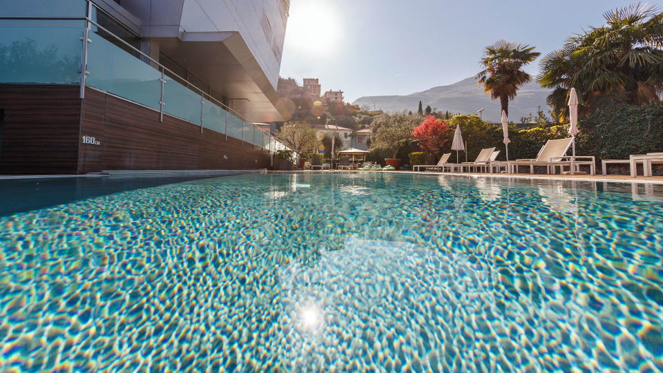
The outdoor pool with palm trees and mountains behind at Bike Hotel Caravel in Torbole

Torbole

2. Caravel Bike Hotel

  • Bike room
  • Wash area
  • Guided rides

The name tells you what the place is built around. The beach at Torbole is roughly 300 metres from the door, the bike room is under video surveillance and there are repair and wash stations. Guided road, mountain and e-bike rides are booked at reception. A sensible choice if the rest of your party plans to swim while you climb.

Best for: Riders travelling with people who would rather swim

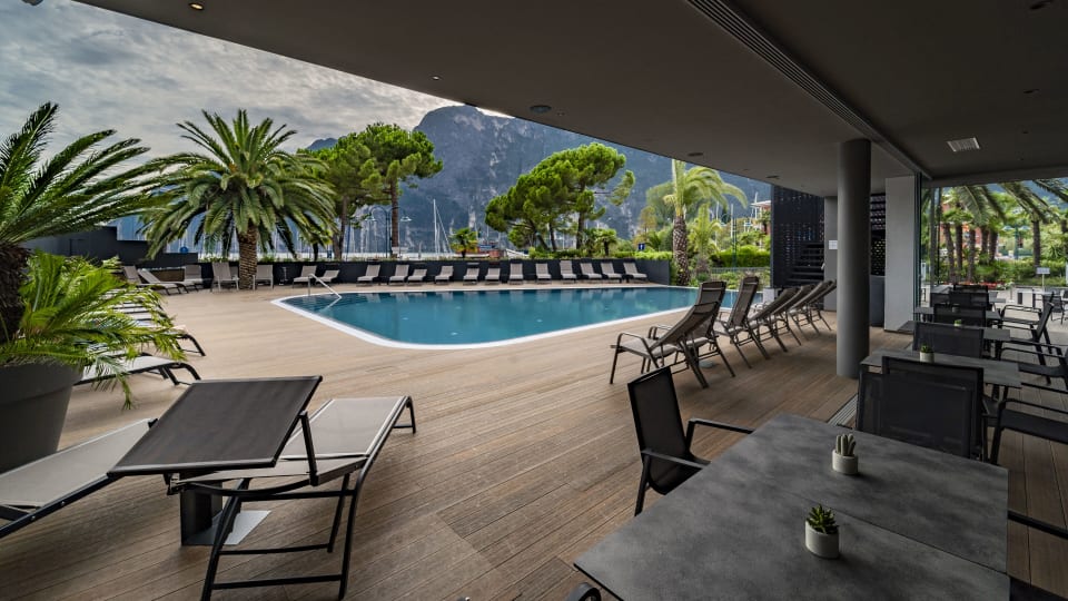
The veranda overlooking the pool at Lake Front Hotel Mirage in Riva del Garda

Riva del Garda

3. Lake Front Hotel Mirage

  • Bike room
  • Workshop
  • Wash area

On the lakefront in Riva, close to the path to Torbole and the road west towards Limone. It has a monitored bike room, a workshop and a wash area, and works with partners on hire and repairs. Riva is larger than Torbole, with more choice for dinner after a long day.

Best for: Staying on the water in Riva

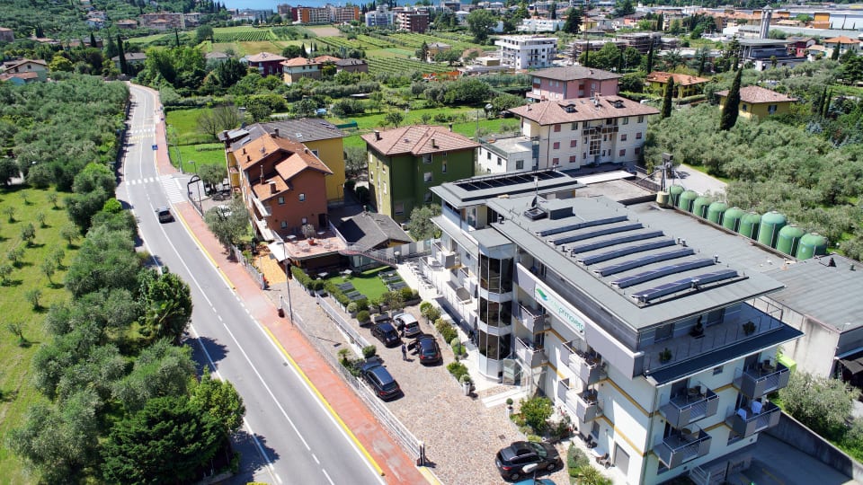
Aerial view of Ecohotel Primavera and the surrounding streets of Riva del Garda

Riva del Garda

4. Ecohotel Primavera

  • Bike room
  • Workshop
  • Shuttle

A smaller hotel in Riva with a locked, camera-watched bike room, a workshop and a wash area. Through partners it can arrange hire, repairs and bike transfers. Suits riders who want to climb out of Arco by day and spend evenings in Riva.

Best for: A quieter base in Riva

How Picolo chooses

Our editors pick every hotel and experience themselves, and most of them we have tried. Nobody can pay to be included or ranked higher. When you book through our links, Picolo earns a small commission. It never changes the price you pay, and it never decides what we write.

Frequently asked questions

Is Lake Garda flat for cycling?

Only at the southern end. Around Peschiera, Sirmione and along the Mincio it is nearly flat, while the north has climbs of more than 1,000 metres straight from the shore.

Can you take bikes on Lake Garda ferries?

Yes, on all ordinary services, but not on catamarans or fast boats. Some sailings have limited space for bikes, so check before boarding.

Can you cycle through the tunnels around Lake Garda?

There is no general ban, but front and rear lights are compulsory and reflective clothing is recommended. At Sperone, north of Limone, the link onto the main road is closed to southbound cyclists.

Is the Strada della Forra open to cyclists?

It has been closed for long periods since a rockfall in 2023. It reopened one way uphill in August 2025 but has had further closures, so check the latest notice before you go.

Where is the best base for road cycling at Lake Garda?

Riva del Garda, Torbole or Arco at the northern end. From there you can reach Monte Baldo, Tremosine and Passo Santa Barbara without loading the bike into a car.