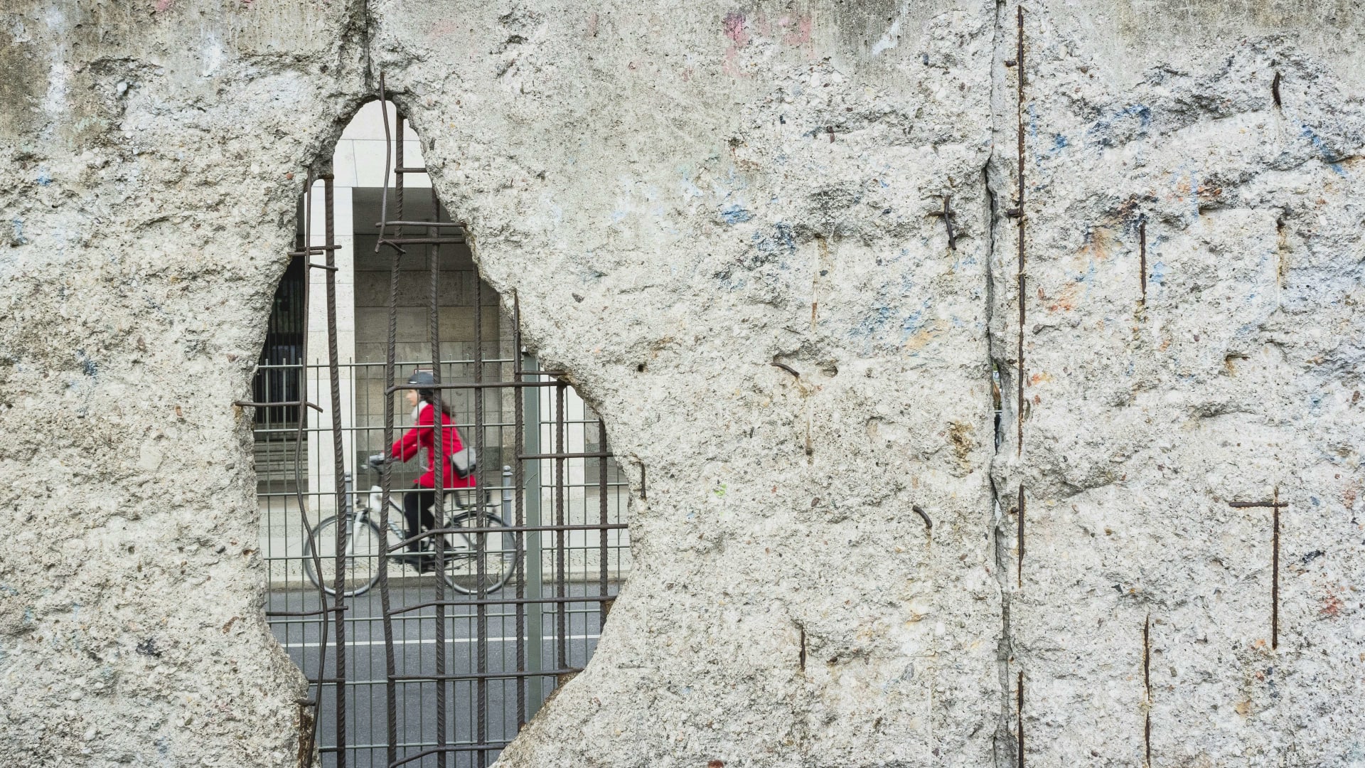
A cyclist seen through a hole with exposed rebar in a concrete wall in Berlin

Cycling in Germany

Berlin Wall Trail cycling: 160 km around the city along the line of the Wall

A double row of cobblestones crosses the tarmac in the middle of Berlin. It is easy to ride over without noticing. Follow it, then the signs out of the city, and you can circle what was once West Berlin.

17 November 20269 min read

© Morgana Bartolomei / Unsplash

Sunday morning on Bernauer Straße. The tour groups have not arrived yet, and the grass where the death strip once ran is quiet. You roll past the memorial, where a stretch of the border installations still stands, and a few kilometres later you reach the Brandenburg Gate without ever leaving the old frontier.

The Berlin Wall Trail, the Berliner Mauerweg in German, traces the former border around West Berlin for about 160 km, through the city centre, leafy suburbs, forest and along lakes. Much of it follows the Kolonnenweg, the patrol road used by East German border guards, and it is signposted the whole way. You may know Berlin from a city break. The trail shows you a different city, at the speed a bike allows history to sink in.

In short

  • Flat: There are no climbs worth mentioning. What takes time is the distance, the stops and the traffic lights in the centre.

  • Distance: About 160 km in 14 stages of 7 to 21 km, each starting and ending near public transport.

  • Surface: Mostly firm paths on the old customs and patrol roads, with cobbles and city streets in the centre.

  • Traffic: The centre has city traffic and crowds. The outer ring towards Brandenburg is quiet.

  • Trains: You can take a bike on the S-Bahn and U-Bahn with a bike ticket, in marked carriages only.

The Berlin Wall Trail at a glance

Length
about 160 km around former West Berlin
Stages
14 7 to 21 km each
Information points
40 with maps and text in several languages
Cobblestone line in the centre
5.7 km marking where the Wall stood
East Side Gallery
1.3 km longest surviving section, painted in 1990
Deaths at the Wall
at least 140 1961 to 1989
Terrain
Flat no climbs worth mentioning
Bikes on the S-Bahn
Yes with a bike ticket, in marked carriages
Ferry with bikes
F10 across the Wannsee start of the stage to Staaken

Last checked:

Chapter 1 · Bernauer Straße

at least 140

people killed at the Berlin Wall

The street that was split in two

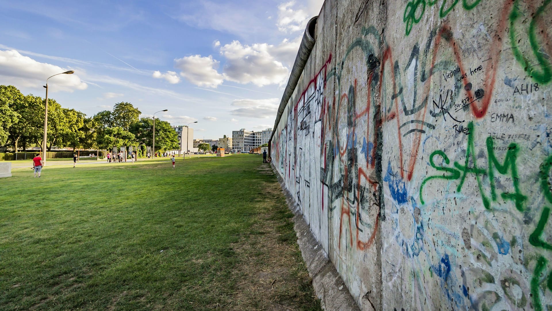
The Berlin Wall Memorial runs for 1.4 km along Bernauer Straße. A preserved stretch of the border strip stands here with its watchtower, and in the grounds the Window of Remembrance commemorates those who died at the Wall.

A graffiti-covered remnant of the Berlin Wall beside a strip of lawn

Chapter 2 · The centre

28 years

the Wall divided the city, 1961 to 1989

The cobbles you barely notice

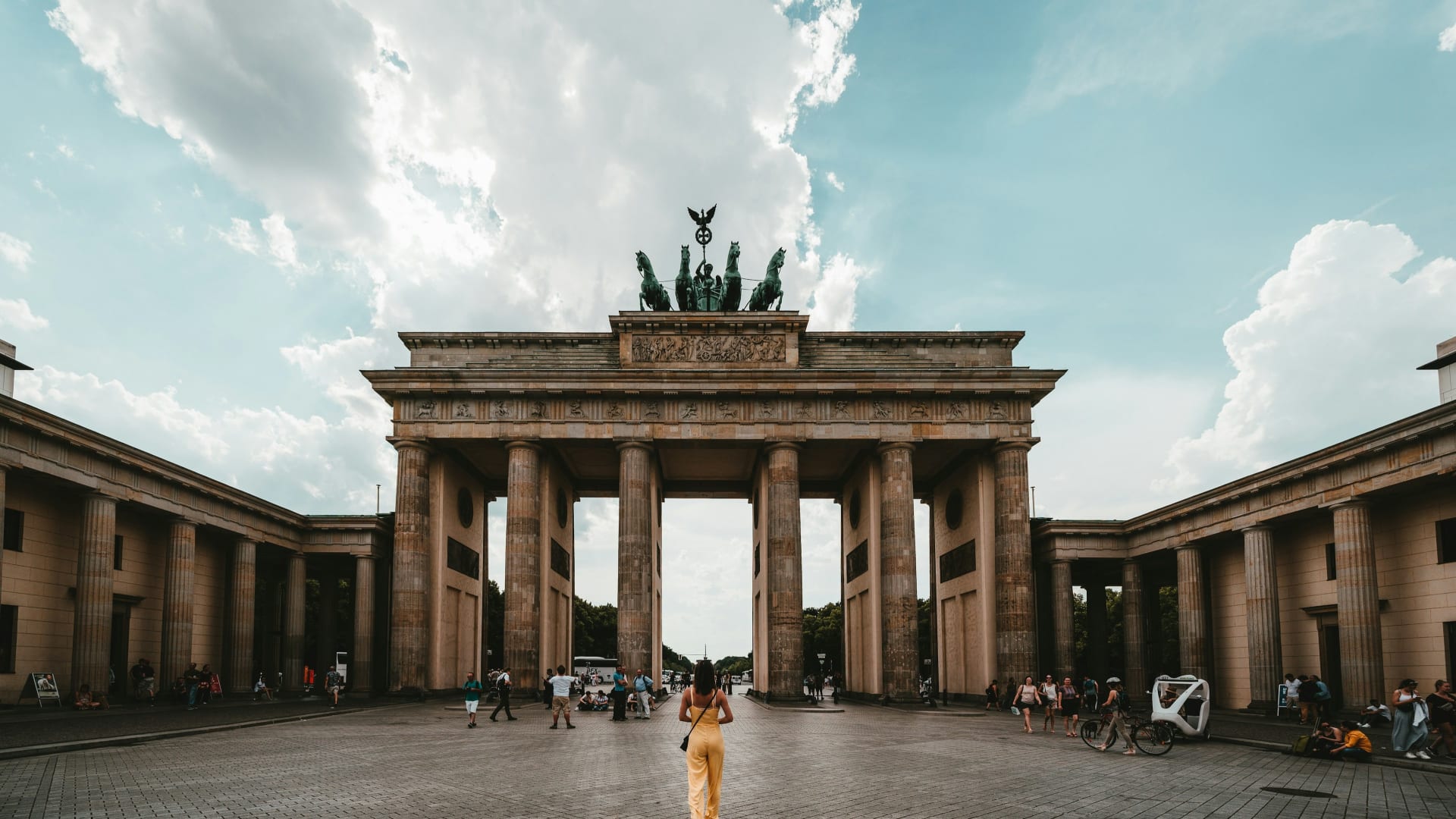
In the centre the Wall has gone, but a double row of cobblestones shows where it ran. It passes the Brandenburg Gate and Potsdamer Platz, and along much of the way it is all that remains.

The Brandenburg Gate in Berlin

Chapter 3 · The Spree

1990

the year artists painted the East Side Gallery

The wall that became a gallery

Along the Spree stands the East Side Gallery, the longest surviving section of the Wall, painted by artists in 1990. Nearby, the Oberbaum Bridge crosses the river at what was once a border crossing.

The Oberbaum Bridge over the Spree in Berlin on a sunny day

Chapter 4 · Wannsee

about 160 km

the full loop

A border on the water

In the south-west the border ran through the lakes. The trail crosses the Glienicke Bridge and takes the BVG ferry F10 across the Wannsee, and at the Groß Glienicker See the line ran through the middle of the bathing lake.

A view between trees across the Wannsee with sailing boats

Flat, but long

Berlin is flat, and the Wall Trail has no climbs worth mentioning. What decides how far you get in a day is how often you stop. Along the way stand 40 information points with maps and text, and in many places orange posts tell the stories of people killed at the Wall. They are hard to ride past.

The trail has three distinct characters. The centre, from Bernauer Straße via the Brandenburg Gate and Potsdamer Platz to the East Side Gallery, means city traffic, cobbles, crowds and traffic lights. You ride slowly here. The south-east takes you through the suburbs out towards Schönefeld and Lichtenrade. The west and north, from Griebnitzsee via Wannsee and Staaken to Hennigsdorf, follow the Havel river, run through woodland and pass lakes, and this is the trail at its best.

The surface is mostly firm, on the old Zollweg and Kolonnenweg, the customs and patrol roads, but it varies, and there are cobbles in the centre. An ordinary hybrid or touring bike is the right choice. A road bike works, but the cobbles are no fun on narrow tyres.

Road bike handlebars in a cycle lane on a Berlin street in evening sunFlorian Kurrasch / Unsplash
The centreIn town you share the road with the traffic. Out on the ring you have it to yourself.

Routes we recommend

Easy: the centre in an afternoon

Nordbahnhof to Potsdamer Platz is 7 km, and Potsdamer Platz to Warschauer Straße another 7. That gives you Bernauer Straße, the Brandenburg Gate, Checkpoint Charlie and the East Side Gallery in 14 km. Allow half a day, because you will stop.

Moderate: Griebnitzsee to Staaken

Two stages in the south-west, 33 km in total. From Griebnitzsee you cross the Glienicke Bridge to Wannsee (12 km), take the F10 ferry across the lake and carry on past Sacrow and the Groß Glienicker See to Staaken (21 km). This is the trail at its greenest and wettest.

Hard: the full loop

About 160 km. Strong riders can do it in one long day, but two or three days leave time for the memorials. Break it at Wannsee and Hennigsdorf, and take the S-Bahn back to your hotel in the evening.

Bernauer StraßeBrandenburg Gate41 mPotsdamer Platz52 mCheckpoint Charlie43 mEast Side Gallery32 mWarschauer Straße36 m

Simplified map of two of the 14 stages. Colours show traffic: yellow some. Distances from berlin.de.

The route

The Wall Trail through the centre

Scroll to ride the line of the Wall from Bernauer Straße to the Spree.

  • Bike
  • Some traffic

Bike · 40 → 41 m · Some traffic

Along the Spree to the Gate

From the memorial the trail heads south to the Spree and the government quarter. The Wall ran right by the Brandenburg Gate.

  • Cobbles
  • Crowds

Bike · 7 km from Nordbahnhof · 41 → 52 m · Some traffic

Through the death strip

For 28 years this square was empty border land. Today it is glass towers and traffic.

  • City traffic

Bike · 52 → 43 m · Some traffic

The old crossing point

Tight and crowded. Push the bike for the last stretch, and look for the Peter Fechter memorial nearby.

  • Narrow
  • Crowds

Bike · 43 → 32 m · Some traffic

The gallery on the Spree

The trail crosses Kreuzberg and follows the longest surviving section of the Wall along the river.

  • Murals
  • River

Bike · 7 km from Potsdamer Platz · 32 → 36 m · Some traffic

Over the Oberbaum Bridge

The stage ends at the station, where you can take the S-Bahn on with your bike.

  • S-Bahn
  • Stage end

Traffic and quiet stretches

  • Quiet: The outer ring in the west and north, from Griebnitzsee via Wannsee and Staaken to Hennigsdorf and Hohen Neuendorf, mostly follows its own paths through woodland and beside water.

  • Crowded: In the centre, especially at the Brandenburg Gate, Checkpoint Charlie and the East Side Gallery, expect a lot of visitors. Ride early or push the bike through the busiest parts.

  • City traffic: Between Potsdamer Platz and Warschauer Straße you cross big roads. Berlin has plenty of cycle lanes, but the junctions are large, so take your time.

Bikes on the S-Bahn and hire

On the S-Bahn and U-Bahn you need a separate bike ticket on top of your own fare. It is valid for two hours, and you can change lines. Bikes go only in carriages marked with a bike symbol, and only when there is room: wheelchairs and pushchairs take priority. Bikes are banned on escalators, so use the lifts. Regular buses do not take bikes, and cargo bikes and trailers are not allowed on trains.

Bike hire is easy to find in the centre, and several hotels rent bikes themselves. Bike sharing has been in flux: nextbike was ordered to remove its bikes from the streets after court rulings in 2025 and 2026, while Voi launched 2,000 e-bikes in autumn 2025. Check what is running when you arrive.

An honest caveat: the central stretch is no nature ride. The first kilometres are city, crowds and cobbles. If you only have one day, the outer ring in the west gives you the best ride, while the centre gives you the history.

Sailing boats moored at a jetty on the Havel in BerlinFritz Walter / Unsplash
The HavelIn the west the trail follows the lakes, and the border ran across the water.

Where to stay

Where to stay near the Berlin Wall Trail

We have picked hotels close to the trail in the centre, where you can reach the route and the S-Bahn without detours.

Picolo-redaksjonen

Picolo-redaksjonen · Updated 17 Nov 2026

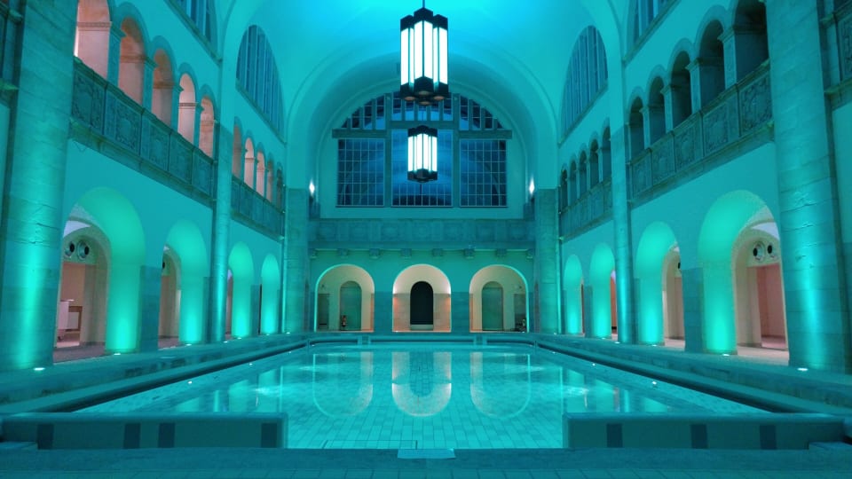
The historic swimming pool at Hotel Oderberger in Berlin

Prenzlauer Berg

1. Hotel Oderberger

  • Pool
  • Near Bernauer Straße

The hotel occupies a public bathhouse from 1902, designed by Ludwig Hoffmann, and the original 20 metre pool is back in use. Bernauer Straße and the Mauerpark, where the Wall ran, are a short ride away. After a long day in the saddle, swim a few lengths under the vaulted ceiling. Ask about bike parking when you book.

Best for: Starting at the Wall memorial

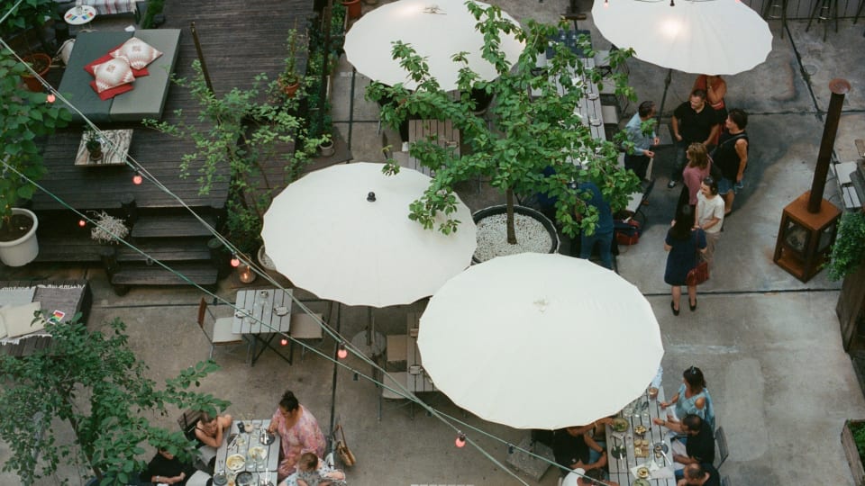
The terrace at Michelberger Hotel in Berlin

Friedrichshain

2. Michelberger Hotel

  • Bike hire
  • By the S-Bahn

On Warschauer Straße, where one of the central stages ends, a few minutes on foot from the East Side Gallery and the Oberbaum Bridge. Michelberger rents out bikes, and the station is close when you head for the outer ring. Lively and informal, and not for anyone who wants quiet evenings.

Best for: Staying by the East Side Gallery

How Picolo chooses

Our editors pick every hotel and experience themselves, and most of them we have tried. Nobody can pay to be included or ranked higher. When you book through our links, Picolo earns a small commission. It never changes the price you pay, and it never decides what we write.

Frequently asked questions

How long is the Berlin Wall Trail?

About 160 km around former West Berlin, split into 14 stages of between 7 and 21 km.

Is the Berlin Wall Trail signposted?

Yes, it is signposted throughout. In the centre a double row of cobblestones also marks where the Wall stood.

Can you take a bike on the S-Bahn in Berlin?

Yes, with a separate bike ticket valid for two hours. Bikes go in marked carriages, and only when there is space.

Which part of the Wall Trail is best to cycle?

The south-west and west, from Griebnitzsee via the Glienicke Bridge and Wannsee to Staaken, with lakes, woodland and little traffic.

How many days do you need for the whole trail?

Strong riders can do it in a day, but two or three days leave time for the memorials and museums along the way.