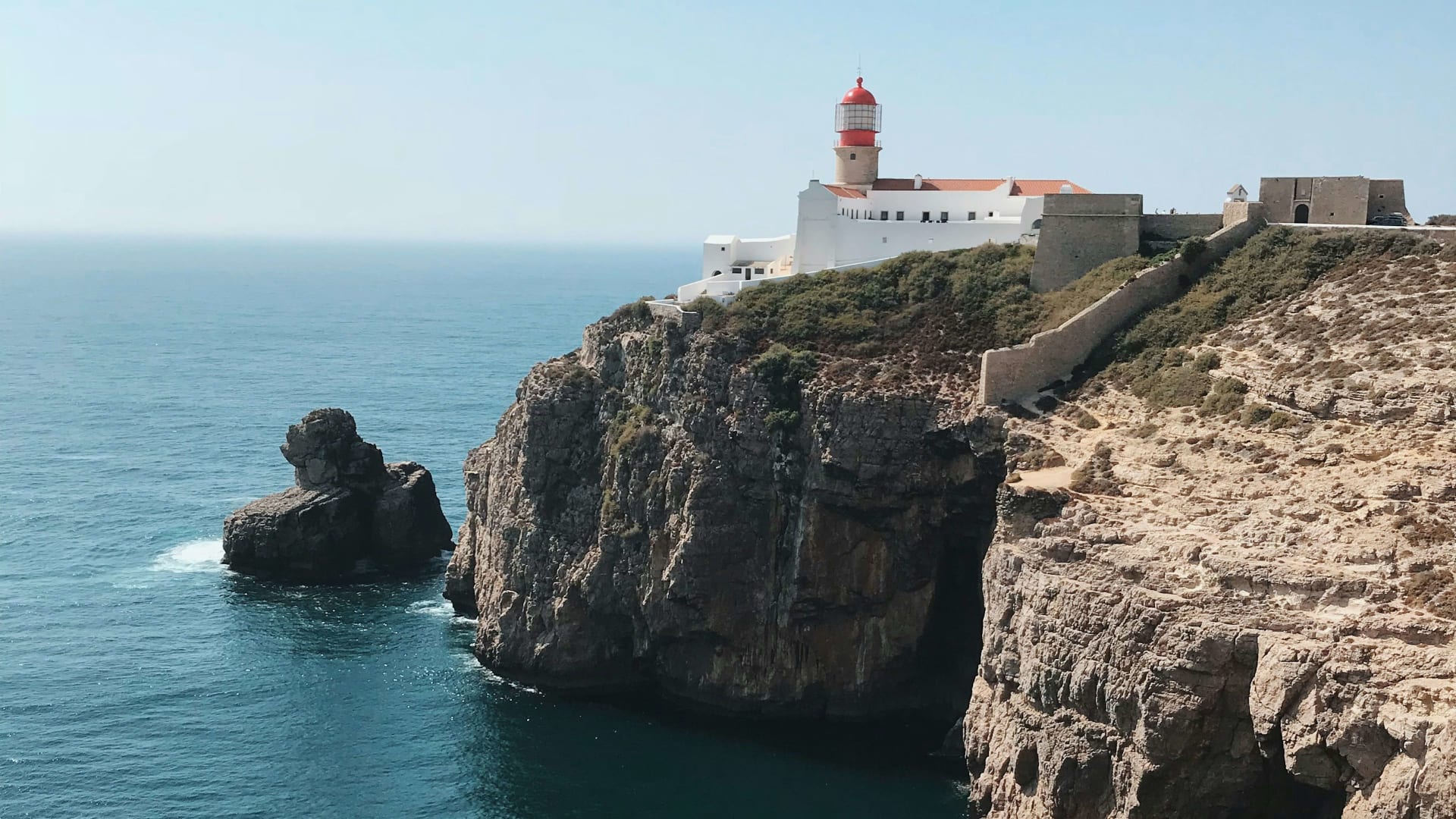
Sheer cliffs and the lighthouse at Cabo de São Vicente above the Atlantic

Cycling in Portugal

Cycling in the Algarve: the coastal Ecovia, the climb to Fóia and the road to avoid

At Cabo de São Vicente the wind never quite drops, and the Atlantic breaks against the cliffs below the lighthouse. From here the Ecovia runs 214 km east to the Spanish border. This is how to use it, and how to stay off the EN125.

17 November 20269 min read

© Reiseuhu / Unsplash

Early morning at the lighthouse on Cabo de São Vicente, the south-western corner of mainland Europe. The tour coaches have not arrived, and the road back to Sagres is nearly empty. This is where the Ecovia do Litoral begins, the cycle route that follows the whole Algarve coast to Vila Real de Santo António on the Guadiana river.

The professionals come here too: the Volta ao Algarve stage race has finished on top of Alto do Malhão in recent years. But for cyclists the region is really two places. The coast is busy, and its main road, the EN125, has been named the most dangerous in Portugal. Inland, the mountains around Monchique and the hills of the Serra do Caldeirão have quiet lanes and proper climbs. The trick is to use the coast to get around and the interior to ride.

In short

  • Flat or hilly: The eastern coast, from Faro to Spain, is almost flat and runs beside the Ria Formosa lagoon. West of Faro it turns rolling, and inland you will find climbs of several hundred metres.

  • Traffic: Avoid the EN125, the main coast road. The Ecovia uses quiet roads, cycle paths and gravel tracks, though in places it crosses or briefly follows bigger roads.

  • The long route: The Ecovia do Litoral is about 214 km and usually ridden in six stages.

  • When to go: Spring and autumn, from March to May and from September to November. July and August are hard work in the middle of the day.

  • Where to stay: Sagres in the west, Monchique for the mountain, Tavira in the east.

The Algarve by bike at a glance

Ecovia do Litoral
about 214 km Cabo de São Vicente to Vila Real de Santo António
Highest point
902 m Fóia, in the Serra de Monchique
Longest climb
16.4 km Fóia from Caldas de Monchique, 795 m of ascent
Road to avoid
EN125 ranked among Portugal's most dangerous roads
Part of
EuroVelo 1 the Atlantic Coast Route to North Cape
Flat section
69 km Vila Real de Santo António to Faro
Best months
Mar to May, Sep to Nov summer middays are tough
Bikes on trains
Yes one per passenger, space limited
Pro finish climb
Alto do Malhão Volta ao Algarve summit finish

Last checked:

Chapter 1 · Lagos

12

municipalities along the Ecovia do Litoral

The cliffs in the west

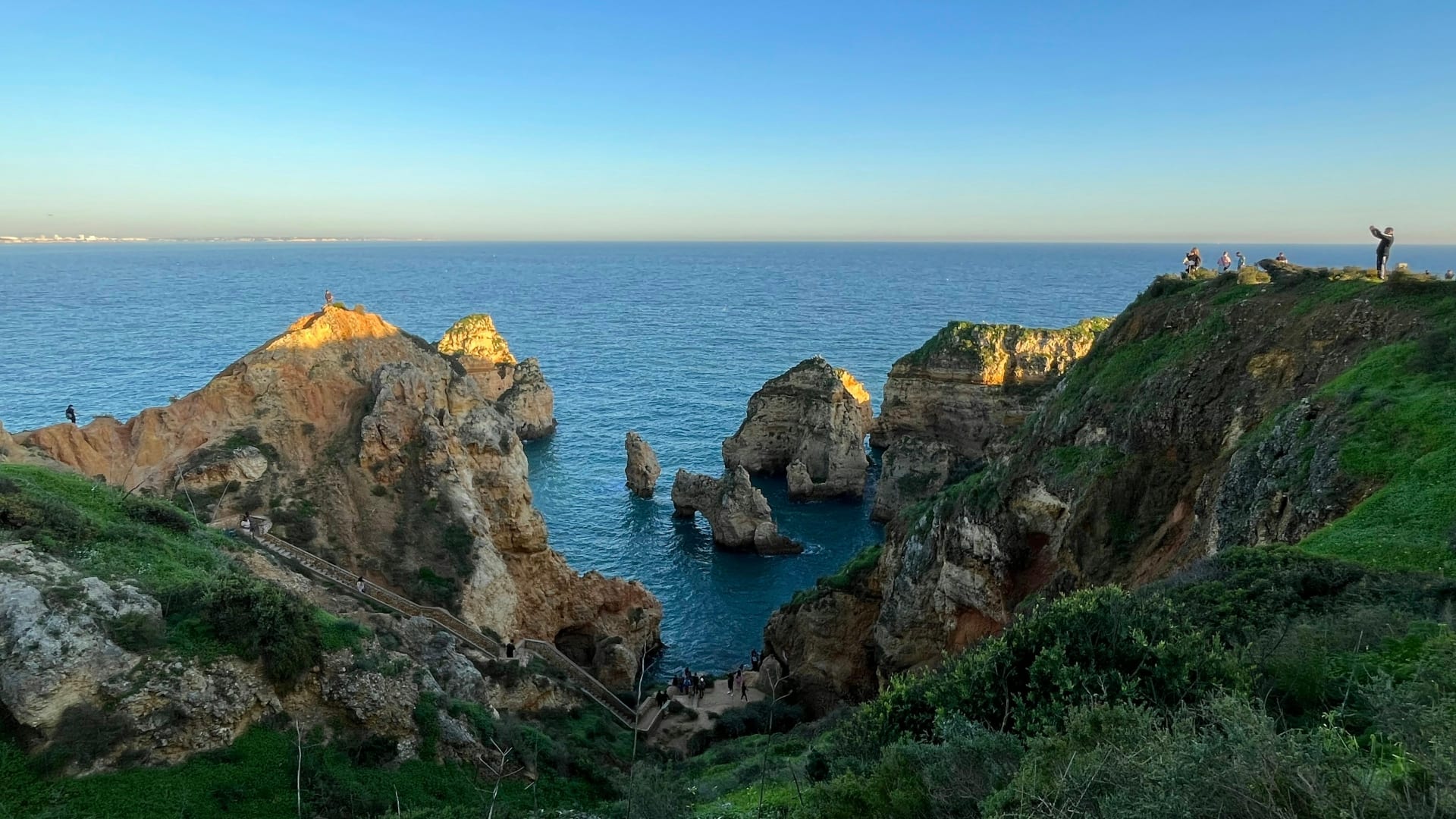
West of Faro the coast rises into limestone cliffs and small coves. The Ecovia here often runs on gravel, sandy in places, and some stretches are no place for a road bike.

Golden limestone cliffs at Ponta da Piedade near Lagos in the Algarve

Chapter 2 · Monchique

902 m

the summit of Fóia

The mountain behind the beaches

Fóia is the Algarve's highest mountain, and a paved road runs to the summit. From Caldas de Monchique you climb about 800 metres in 16 km. On a clear day you can see the Atlantic from the top.

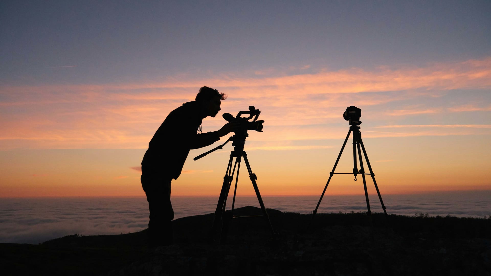
Silhouette of a photographer with a camera on a tripod at sunset in the Monchique mountains

Chapter 3 · Ria Formosa

69 km

from Faro to the Spanish border

The flat east

From Faro to Vila Real de Santo António it is 69 km beside the lagoon, past Olhão, Fuseta, Tavira and Cacela Velha. This is the calmest and flattest part of the Ecovia.

Aerial view of the narrow sand spit at Fuseta between the sea and the Ria Formosa lagoon

Chapter 4 · EN125

EN125

the main coast road

The road not to ride

Portugal's road safety authority, ANSR, named the EN125 the country's most dangerous road. Lorries, coaches and local traffic share it along the whole coast. The Ecovia exists so you do not have to.

Flat by the sea, steep in the hills

The Algarve is only flat while you stay by the water. The eastern coast from Faro to Spain is almost level. Here the Ecovia follows the Ria Formosa lagoon through fishing towns, and it suits e-bikes and anyone who wants to cover distance without climbing.

Inland is another story. Fóia, in the Serra de Monchique, is 902 metres high and the Algarve's highest point. The long road up from Caldas de Monchique is 16.4 km at an average of 4.9 per cent, gaining 795 metres along the EN266 and the Estrada da Fóia. From Portela da Nave it is just 7.4 km, but averages 8 per cent, and the steepest 100 metres have been measured at 22 per cent.

Further east, Alto do Malhão in the Serra do Caldeirão north of Loulé is only 2.6 km long but averages 9.8 per cent, and it was the summit finish of the Volta ao Algarve in both 2025 and 2026. The lanes around Malhão and Salir are narrow and carry little traffic.

A palm tree and rolling hills at sunset inland near LouléLeonardo Ferreira / Unsplash
InlandThe hills behind Loulé are where the quiet roads are.

The climbs

Three climbs in the hills behind the coast

The Algarve's climbing is all inland. Here are both roads to the region's highest summit, and the pros' favourite finish.

Fóia from Caldas de Monchique · Some traffic

Fóia: the long way up

From the old spa village of Caldas de Monchique you climb through Monchique town and on to the summit. The gradient is moderate, but it adds up to almost 800 metres. Riders on climbfinder.com report moderate traffic.

From / To
Caldas de Monchique 100 m → Fóia 896 m
Length
16.4 km
Average
4.9 %
Max
11.1 %

Fóia from Portela da Nave · Light traffic

Fóia: short and steep

Half the length and nearly twice the average gradient. The steepest 100 metres have been measured at 22 per cent. Traffic is light, but the road is narrow.

From / To
Portela da Nave 310 m → Fóia 896 m
Length
7.4 km
Average
8 %
Max
22 %

Alto do Malhão · Light traffic

Malhão: the pros' finish line

Only 2.6 km, but averaging 9.8 per cent with a steepest section of 15.6. The Volta ao Algarve has finished here in recent years. The roads around it are quiet.

From / To
Cortinhola 264 m → Alto do Malhão 514 m
Length
2.6 km
Average
9.8 %
Max
15.6 %

Routes we recommend

Easy: Faro to Tavira along the lagoon

The eastern Ecovia is flat and follows the Ria Formosa past Olhão and Fuseta. Carry on from Tavira to Vila Real de Santo António and you have ridden the full 69 km of the eastern coast. The coastal railway brings you back.

Moderate: Monchique and Fóia

Base yourself in Monchique and ride up Fóia from Portela da Nave early, before the traffic. Descend towards Caldas de Monchique and add a loop through the hills. Short on kilometres, long on climbing.

Hard: the whole Ecovia

About 214 km from Cabo de São Vicente to Vila Real de Santo António, usually split into six stages. West of Faro there is a lot of gravel, some of it sandy, so a gravel or mountain bike is a better choice than a road bike. Plan overnight stops in places such as Lagos, Portimão, Albufeira, Faro and Tavira.

Cabo de São VicenteSagres29 mLagos13 mFaro16 mTavira6 mVila Real de Santo António9 m

Simplified map. Colours show traffic: green light, yellow some. The full route is about 214 km, and Faro to Vila Real de Santo António is 69 km.

The route

The Ecovia from lighthouse to border

Scroll to ride the Algarve coast from Cabo de São Vicente to Spain.

  • Bike
  • Gravel
  • Light traffic
  • Some traffic

Bike · 26 → 29 m · Light traffic

Lighthouse to Sagres

A short opening stage across the open headland. Early in the morning you have the road almost to yourself.

  • Short stage
  • Wind

Gravel · 29 → 13 m · Some traffic

Gravel and hills to Lagos

The western coast is rolling, and much of the Ecovia is gravel. Expect more traffic closer to town.

  • Gravel
  • Rolling

Gravel · 13 → 16 m · Some traffic

The busy central coast

Between Portimão and Faro the resorts sit close together. The route alternates between quiet roads and gravel, often sandy, and crosses bigger roads.

  • Gravel
  • Crossings

Bike · 16 → 6 m · Light traffic

Along the lagoon to Tavira

East of Faro the land flattens out. The route follows the Ria Formosa past Olhão and Fuseta to Tavira.

  • Flat
  • Lagoon

Bike · 6 → 9 m · Light traffic

To the border on the Guadiana

The last stretch passes Cabanas, Cacela Velha and Monte Gordo to the river that divides Portugal from Spain.

  • Flat
  • Finish

Quiet lanes and the road to avoid

  • Quiet: The inland roads in the Serra de Monchique and the Serra do Caldeirão, around Salir and Alto do Malhão, carry little traffic. The eastern Ecovia along the Ria Formosa is calm as well.

  • Busy: The EN125 runs the length of the coast. In 2017 ANSR, Portugal's road safety authority, named it the country's most dangerous road, and in 2023 it was still among the five deadliest. Lorries, coaches and local traffic mix, and some sections run for kilometres with nowhere to overtake.

  • Gravel and sand: West of Faro the Ecovia often runs on gravel that can be sandy, and it puddles after rain. Wider tyres make for a better day.

Bike hire and trains

You will find bike hire in the larger coastal towns, and several hotels rent bikes themselves. CP, Portugal's national railway, carries bikes free of charge, one per passenger, though space is limited and staff decide before you board. The Algarve line between Lagos and Vila Real de Santo António went fully electric in July 2026, so check the bike rules on the new trains with CP before you travel. The train is an easy way back after a coastal stage.

An honest caveat: the Ecovia is not a continuous cycle path. Its signage has been criticised, and some stretches suit a mountain bike better than a road bike. Download the GPX track from EuroVelo Portugal before you go.

Whitewashed church buildings and tiled roofs under a starry sky in TaviraTanguy Sauvin / Unsplash
TaviraThe calm east coast is the best place to end a long day in the saddle.

Where to stay

Bike friendly hotels in the Algarve

We have chosen hotels in the west, in the mountains and in the east. Two are set up for cyclists, two sit right by the Ecovia.

Picolo-redaksjonen

Picolo-redaksjonen · Updated 17 Nov 2026

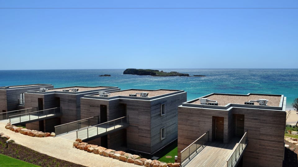
Martinhal Sagres from the outside

Sagres

1. Martinhal Sagres

  • Bike hire
  • Workshop
  • Wash station
  • Guided rides

This resort near Sagres has the most complete cycling set-up we found in the Algarve: hire bikes including road bikes, secure storage, a wash station, a workshop and scheduled guided rides. The Ecovia starts a few kilometres away at the lighthouse. A good fit for families where not everyone wants to ride the same distance.

Best for: Riders who want everything on site

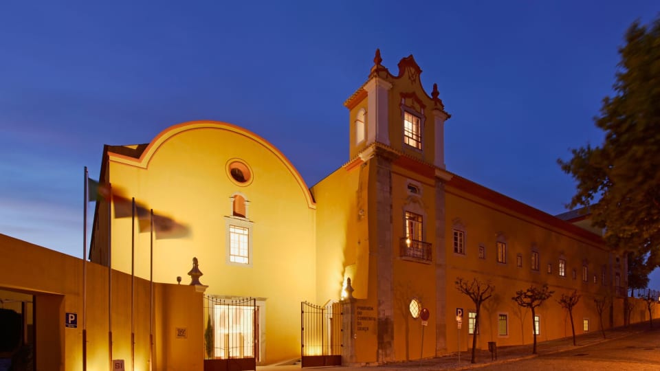
Pousada Tavira in the old convent in Tavira

Tavira

2. Pousada Tavira

  • On the Ecovia
  • Old town

The pousada occupies a former convent on the hill in Tavira, with a pool in the cloister garden. The Ecovia passes through town and the lagoon is close by. It is not a cycling hotel, so ask about bike storage when you book. In return you have one of the Algarve's loveliest old towns on the doorstep.

Best for: Ending the day in an old town

How Picolo chooses

Our editors pick every hotel and experience themselves, and most of them we have tried. Nobody can pay to be included or ranked higher. When you book through our links, Picolo earns a small commission. It never changes the price you pay, and it never decides what we write.

Frequently asked questions

When is the best time to cycle in the Algarve?

March to May and September to November. Winters are mild but wetter, and in July and August the middle of the day is hard going.

Is the Ecovia do Litoral paved?

Not all of it. It alternates between quiet roads, cycle paths and gravel, and west of Faro the gravel is sandy in places.

Can you take a bike on the train in the Algarve?

Yes. CP carries bikes free, one per passenger, but space is limited. Check the rules for the new electric trains on the Algarve line before you go.

How high is Fóia?

Fóia stands 902 metres above sea level and is the highest point in the Algarve. A paved road goes all the way up, and the longest climbs start in Caldas de Monchique.

Is the Algarve good for road cycling?

Yes, inland. The mountain roads around Monchique and Malhão suit a road bike, while parts of the coastal Ecovia are better on a gravel or mountain bike.